
Size of this preview:
800 × 533 pixels. Other resolutions:
320 × 213 pixels |
640 × 427 pixels |
1,024 × 683 pixels |
1,500 × 1,000 pixels.
Original file (1,500 × 1,000 pixels, file size: 411 KB, MIME type: image/jpeg)
| This is a file from the
Wikimedia Commons. Information from its
description page there is shown below. Commons is a freely licensed media file repository. You can help. |
Summary
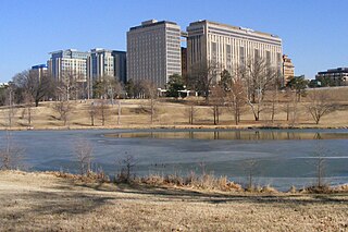
| Description | Jefferson Lake in Forest Park in St. Louis, looking toward Barnes-Jewish Hospital. |
| Date | |
| Source | Own work |
| Author | Bluelion |
| Camera location | | View this and other nearby images on: OpenStreetMap |
|
|---|
Licensing
| I, the copyright holder of this work, release this work into the
public domain. This applies worldwide. In some countries this may not be legally possible; if so: I grant anyone the right to use this work for any purpose, without any conditions, unless such conditions are required by law. |
File history
Click on a date/time to view the file as it appeared at that time.
| Date/Time | Thumbnail | Dimensions | User | Comment | |
|---|---|---|---|---|---|
| current | 05:34, 26 January 2009 |
| 1,500 × 1,000 (411 KB) | Bluelion~commonswiki | {{Information |Description=Jefferson Lake in Forest Park in St. Louis, looking toward Barnes-Jewish Hospital. |Source=self-made |Date=22 January 2009 |Author= Bluelion |Permi |
File usage
The following pages on the English Wikipedia use this file (pages on other projects are not listed):
Global file usage
The following other wikis use this file:
- Usage on ar.wikipedia.org
- Usage on arz.wikipedia.org
- Usage on fa.wikipedia.org
- Usage on ku.wikipedia.org
- Usage on ru.wikipedia.org
- Usage on tr.wikipedia.org
- Usage on uk.wikipedia.org
- Usage on www.wikidata.org