
Size of this preview:
468 × 599 pixels. Other resolutions:
187 × 240 pixels |
375 × 480 pixels |
600 × 768 pixels |
800 × 1,024 pixels |
1,600 × 2,048 pixels |
3,000 × 3,840 pixels.
Original file (3,000 × 3,840 pixels, file size: 8.08 MB, MIME type: image/jpeg)
| This is a file from the
Wikimedia Commons. Information from its
description page there is shown below. Commons is a freely licensed media file repository. You can help. |
Summary
| Description |
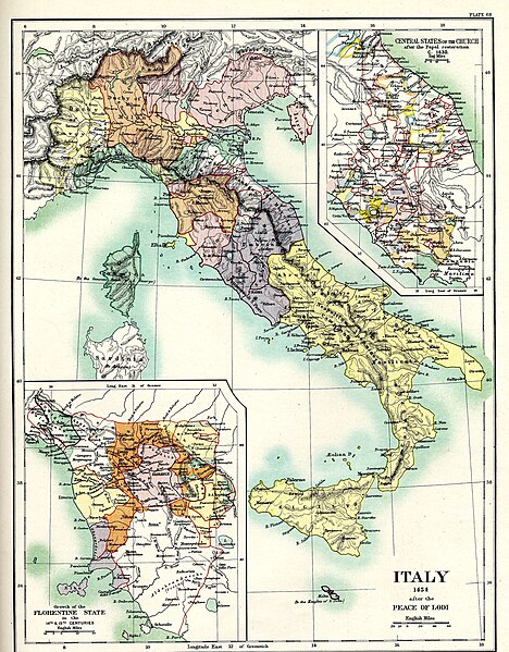
English: "Italy 1454 after the Peace of Lodi", Plate 68 from Reginald Lane Poole's Historical Atlas of Modern Europe. Inset maps of the "Central States of the Church after the Papal restoration c. 1430" to the top right and the "Growth of the Florentine State in the 14th & 15th Centuries" to the bottom left.
Deutsch: Italien nach dem Frieden von Lodi 1454. |
| Date | |
| Source | Historical Atlas of Modern Europe, Oxford:Clarendon Press. |
| Author | Reginald Lane Poole |
| Other versions |
|


Licensing
|
This work is in the public domain in its country of origin and other countries and areas where the copyright term is the author's life plus 70 years or fewer. This work is in the public domain in the United States because it was published (or registered with the U.S. Copyright Office) before January 1, 1929. | |
| This file has been identified as being free of known restrictions under copyright law, including all related and neighboring rights. | |
File history
Click on a date/time to view the file as it appeared at that time.
| Date/Time | Thumbnail | Dimensions | User | Comment | |
|---|---|---|---|---|---|
| current | 00:41, 4 November 2015 |
| 3,000 × 3,840 (8.08 MB) | Πυλαιμένης | User created page with UploadWizard |
File usage
The following pages on the English Wikipedia use this file (pages on other projects are not listed):
Global file usage
The following other wikis use this file:
- Usage on ar.wikipedia.org
- Usage on ca.wikipedia.org
- Usage on de.wikipedia.org
- Usage on el.wikipedia.org
- Usage on es.wikipedia.org
- Usage on et.wikipedia.org
- Usage on hu.wikipedia.org
- Usage on it.wikipedia.org
- Usage on ko.wikipedia.org
- Usage on pl.wikipedia.org
- Usage on pnb.wikipedia.org
- Usage on pt.wikipedia.org
- Usage on ru.wikipedia.org
- Usage on tr.wikipedia.org
- Usage on uk.wikipedia.org
- Usage on ur.wikipedia.org
- Usage on vec.wikipedia.org
- Usage on www.wikidata.org
- Usage on zh.wikipedia.org