
Size of this preview:
800 × 533 pixels. Other resolutions:
320 × 213 pixels |
640 × 427 pixels |
1,024 × 683 pixels |
1,280 × 853 pixels |
2,560 × 1,707 pixels |
5,568 × 3,712 pixels.
Original file (5,568 × 3,712 pixels, file size: 5.89 MB, MIME type: image/jpeg)
| This is a file from the
Wikimedia Commons. Information from its
description page there is shown below. Commons is a freely licensed media file repository. You can help. |
Summary
| Description |
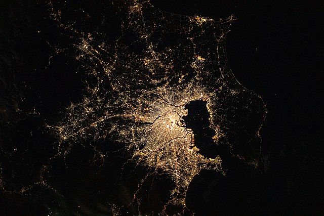
English: View of Earth taken during ISS Expedition 64. |
| Date | |
| Source | JSC Gateway to Astronaut Photography of Earth |
| Author | Earth Science and Remote Sensing Unit, NASA Johnson Space Center |
| Sun Azimuth | 76° |
| Sun Elevatation | -34° |
| Altitude | 223 nautical miles (413 km) |
| Mission | ISS064 |
| Roll | E |
| Frame | 37584 |
| Camera | NIKON D5 S/N: 3502421 |
| Focal length | 58 mm |
| Camera location |
| View this and other nearby images on: OpenStreetMap |
|
|---|
This image or video was catalogued by Johnson Space Center of the United States
National Aeronautics and Space Administration (NASA) under Photo ID:
ISS064-E-37584. This tag does not indicate the copyright status of the attached work. A normal copyright tag is still required. See Commons:Licensing. Other languages:
|
Licensing
| This file is in the public domain in the United States because it was solely created by NASA. NASA copyright policy states that "NASA material is not protected by copyright unless noted". (See Template:PD-USGov, NASA copyright policy page or JPL Image Use Policy.) | ||
 |
Warnings:
|
File history
Click on a date/time to view the file as it appeared at that time.
| Date/Time | Thumbnail | Dimensions | User | Comment | |
|---|---|---|---|---|---|
| current | 10:20, 24 May 2021 |
| 5,568 × 3,712 (5.89 MB) | Askeuhd |
File usage
The following pages on the English Wikipedia use this file (pages on other projects are not listed):
Global file usage
The following other wikis use this file:
- Usage on gl.wikipedia.org
- Usage on uk.wikipedia.org