
Size of this preview:
800 × 532 pixels. Other resolutions:
320 × 213 pixels |
640 × 426 pixels |
1,024 × 681 pixels |
1,280 × 851 pixels |
2,560 × 1,702 pixels |
6,016 × 4,000 pixels.
Original file (6,016 × 4,000 pixels, file size: 6.26 MB, MIME type: image/jpeg)
| This is a file from the
Wikimedia Commons. Information from its
description page there is shown below. Commons is a freely licensed media file repository. You can help. |
|
This is an image of a place or building that is listed on the
National Register of Historic Places in the
United States of America. Its reference number is
83003056. |
| Camera location |
| View this and other nearby images on: OpenStreetMap |
|
|---|
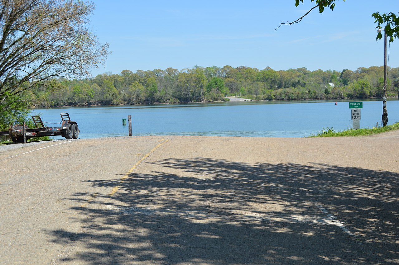
| Description |
English: Overview from the west (the
Rhea County side) of the site of the
Hastings-Locke Ferry, which formerly carried
State Route 30 over the
Tennessee River between
Dayton and
Decatur in the
U.S. state of
Tennessee. The ferry site is listed on the
National Register of Historic Places. |
||
| Date | Taken on 20 April 2014 | ||
| Source | Own work | ||
| Author | Nyttend | ||
| Permission ( Reusing this file) |
|
File history
Click on a date/time to view the file as it appeared at that time.
| Date/Time | Thumbnail | Dimensions | User | Comment | |
|---|---|---|---|---|---|
| current | 03:24, 29 April 2014 |
| 6,016 × 4,000 (6.26 MB) | Nyttend | {{NRHP|83003056}} {{Location|35|32|16|N|84|53|1|W}} {{Information |Description={{en|Overview from the west (the {{w|Rhea County, Tennessee|Rhea County}} side) of the site of the {{w|Hastings-Locke Ferry}}, which formerly carried {{w|Tennessee State Rou... |
File usage
The following pages on the English Wikipedia use this file (pages on other projects are not listed):
Global file usage
The following other wikis use this file:
- Usage on www.wikidata.org