No higher resolution available.
Fort_Union.jpg (600 × 346 pixels, file size: 25 KB, MIME type: image/jpeg)
| This is a file from the
Wikimedia Commons. Information from its
description page there is shown below. Commons is a freely licensed media file repository. You can help. |
Summary
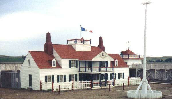
| Description | Picture of Fort Union Trading Post National Historic Site on the North Dakota / Montana Border |
| Date | |
| Source | http://nd.water.usgs.gov/lewisandclark/photos10.html |
| Author | U.S. Geological Society |
| Object location |
| View this and other nearby images on: OpenStreetMap |
|
|---|
Licensing
This image is in the
public domain in the United States because it only contains materials that originally came from the
United States Geological Survey, an agency of the
United States Department of the Interior. For more information, see
the official USGS copyright policy.
|
File history
Click on a date/time to view the file as it appeared at that time.
| Date/Time | Thumbnail | Dimensions | User | Comment | |
|---|---|---|---|---|---|
| current | 16:18, 17 November 2007 |
| 600 × 346 (25 KB) | Spudboy~commonswiki | {{Information |Description=Picture of Fort Union Trading Post National Historic Site on the North Dakota / Montana Border |Source=http://nd.water.usgs.gov/lewisandclark/photos10.html |Date=June 1992 |Author=U.S. Geological Society |Permission= |other_vers |
File usage
The following pages on the English Wikipedia use this file (pages on other projects are not listed):
Global file usage
The following other wikis use this file:
- Usage on ar.wikipedia.org
- Usage on ca.wikipedia.org
- Usage on ceb.wikipedia.org
- Usage on cy.wikipedia.org
- Usage on de.wikipedia.org
- Usage on es.wikipedia.org
- Usage on fr.wikipedia.org
- Usage on ga.wikipedia.org
- Usage on hu.wikipedia.org
- Usage on it.wikipedia.org
- Usage on ja.wikipedia.org
- Usage on ko.wikipedia.org
- Usage on no.wikipedia.org
- Usage on pl.wikipedia.org
- Usage on pt.wikipedia.org
- Usage on ru.wikipedia.org
- Usage on sr.wikipedia.org
- Usage on sv.wikipedia.org
- Usage on tr.wikipedia.org
- Usage on tt.wikipedia.org
- Usage on www.wikidata.org