
Size of this preview:
800 × 304 pixels. Other resolutions:
320 × 122 pixels |
640 × 243 pixels |
1,024 × 389 pixels |
1,280 × 487 pixels |
4,062 × 1,544 pixels.
Original file (4,062 × 1,544 pixels, file size: 4.24 MB, MIME type: image/jpeg)
| This is a file from the
Wikimedia Commons. Information from its
description page there is shown below. Commons is a freely licensed media file repository. You can help. |
Summary
| Description | |
| Date | |
| Source | Own work |
| Author | Two+two=4 |
| Camera location |
| View this and other nearby images on: OpenStreetMap |
|
|---|
Licensing
| I, the copyright holder of this work, release this work into the
public domain. This applies worldwide. In some countries this may not be legally possible; if so: I grant anyone the right to use this work for any purpose, without any conditions, unless such conditions are required by law. |
File history
Click on a date/time to view the file as it appeared at that time.
| Date/Time | Thumbnail | Dimensions | User | Comment | |
|---|---|---|---|---|---|
| current | 23:40, 24 August 2009 |
| 4,062 × 1,544 (4.24 MB) | Two+two=4 | fixed |
| 20:26, 24 August 2009 |
 | 4,116 × 1,700 (4.57 MB) | Two+two=4 | ajusted colors | |
| 14:59, 24 August 2009 |
| 4,353 × 1,719 (5.12 MB) | Two+two=4 | fixed | |
| 14:01, 24 August 2009 |
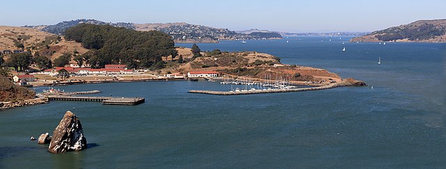
 | 4,444 × 1,897 (4.92 MB) | Two+two=4 | {{Information |Description={{en|1=Fort Baker on San Francisco Bay}} |Source=Own work by uploader |Author= Two+two=4 |Date= |Permission= |other_versions= }} Category:San Francisco Bay |
File usage
The following pages on the English Wikipedia use this file (pages on other projects are not listed):
Global file usage
The following other wikis use this file:
- Usage on ms.wikipedia.org