Original file (2,048 × 2,033 pixels, file size: 460 KB, MIME type: image/jpeg)
| This is a file from the
Wikimedia Commons. Information from its
description page there is shown below. Commons is a freely licensed media file repository. You can help. |
Summary
| Description |
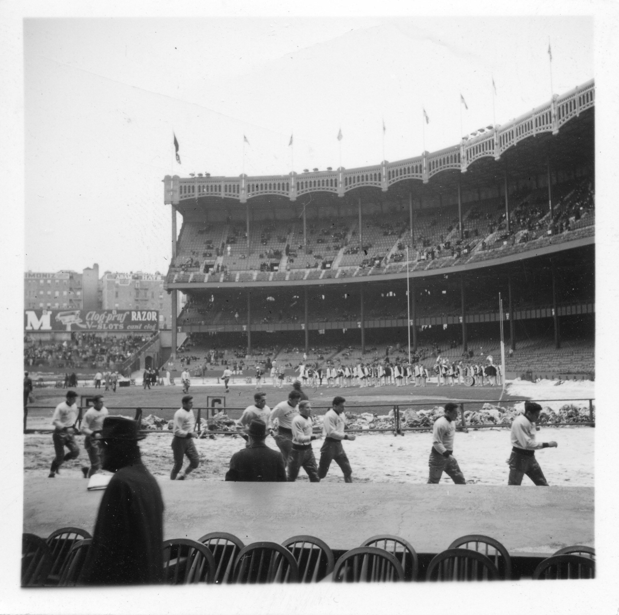
@emstc has corrected me -- this is 1940, not 1936. The rebuilt upper deck shows that it's not 1936, and the ad on the outfield wall shows that it is in fact 1940. So the game is 11/30/1940, still Fordham vs. NYU. It's a better world because their are fanatics of Yankee history. Here is a view back from the buildings in the distance (836 Gerard St, NY, still standing) in 1936.
|
| Source | Post-Lombardi Fordham Rams, Yankee Stadium, 1940 |
| Author | Rob Ketcherside from Seattle, usa |
| Camera location |
| View this and other nearby images on: OpenStreetMap |
|
|---|
Licensing
- You are free:
- to share – to copy, distribute and transmit the work
- to remix – to adapt the work
- Under the following conditions:
- attribution – You must give appropriate credit, provide a link to the license, and indicate if changes were made. You may do so in any reasonable manner, but not in any way that suggests the licensor endorses you or your use.
| This image was originally posted to Flickr by Rob Ketcherside at https://flickr.com/photos/29056926@N02/6626118851. It was reviewed on 12 April 2016 by FlickreviewR and was confirmed to be licensed under the terms of the cc-by-2.0. |
File history
Click on a date/time to view the file as it appeared at that time.
| Date/Time | Thumbnail | Dimensions | User | Comment | |
|---|---|---|---|---|---|
| current | 03:32, 12 April 2016 |
| 2,048 × 2,033 (460 KB) | SteveStrummer | Transferred from Flickr via Flickr2Commons |