Size of this preview:
713 × 600 pixels. Other resolutions:
286 × 240 pixels |
571 × 480 pixels |
913 × 768 pixels |
1,024 × 861 pixels.
Original file (1,024 × 861 pixels, file size: 228 KB, MIME type: image/png)
File history
Click on a date/time to view the file as it appeared at that time.
| Date/Time | Thumbnail | Dimensions | User | Comment | |
|---|---|---|---|---|---|
| current | 00:35, 30 May 2022 |
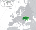
 | 1,024 × 861 (228 KB) | RadomirZinovyev | Redrew 2015 borders for accuracy |
| 06:27, 28 May 2022 |
 | 1,024 × 861 (231 KB) | Durranistan | nagorno-karabakh | |
| 02:29, 18 April 2022 |
 | 1,024 × 861 (228 KB) | Seabourn101 | Reverted to version as of 17:19, 30 April 2015 (UTC)- reverting back to the longstanding version before the 2022 Russian invasion as the battles have not yet settled down | |
| 15:14, 6 April 2022 |
 | 1,024 × 861 (182 KB) | Fogener Haus | update | |
| 18:25, 2 April 2022 |
 | 1,024 × 861 (227 KB) | Fogener Haus | Update around Kyiv | |
| 19:32, 27 March 2022 |
 | 1,024 × 861 (182 KB) | Fogener Haus | update | |
| 18:00, 25 March 2022 |
 | 1,024 × 861 (182 KB) | Jan-LV | Little correstions | |
| 13:15, 19 March 2022 |
 | 1,014 × 860 (258 KB) | Fogener Haus | Update | |
| 15:10, 18 March 2022 |
 | 1,014 × 860 (258 KB) | Fogener Haus | Small fixes | |
| 13:41, 18 March 2022 |
 | 1,014 × 860 (256 KB) | Fogener Haus | Russian invasion |
File usage
The following pages on the English Wikipedia use this file (pages on other projects are not listed):
Global file usage
The following other wikis use this file:
- Usage on alt.wikipedia.org
- Usage on blk.wikipedia.org
- Usage on bn.wikipedia.org
- Usage on br.wikipedia.org
- Usage on cy.wikipedia.org
- Usage on en.wiktionary.org
- Usage on es.wikipedia.org
- Usage on ext.wikipedia.org
- Usage on fa.wikipedia.org
- Usage on gn.wikipedia.org
- Usage on guw.wikipedia.org
- Usage on gv.wikipedia.org
- Usage on he.wikipedia.org
- Usage on kcg.wikipedia.org
- Usage on lez.wikipedia.org
- Usage on mn.wikipedia.org
- Usage on my.wikipedia.org
- Usage on mzn.wikipedia.org
- Usage on nl.wikipedia.org
- Usage on pnb.wikipedia.org
- Usage on sat.wikipedia.org
- Usage on si.wikipedia.org
- Usage on si.wiktionary.org
- Usage on sv.wikipedia.org
- Usage on th.wikipedia.org
- Usage on tl.wikipedia.org
- Usage on tr.wikipedia.org
- Usage on ur.wikipedia.org
- Usage on vls.wikipedia.org
- Usage on zh-yue.wikipedia.org
- Usage on zh.wiktionary.org