
Size of this preview:
800 × 523 pixels. Other resolutions:
320 × 209 pixels |
640 × 418 pixels |
1,024 × 669 pixels |
1,280 × 837 pixels |
2,024 × 1,323 pixels.
Original file (2,024 × 1,323 pixels, file size: 661 KB, MIME type: image/jpeg)
| This is a file from the
Wikimedia Commons. Information from its
description page there is shown below. Commons is a freely licensed media file repository. You can help. |
Summary
| Description |
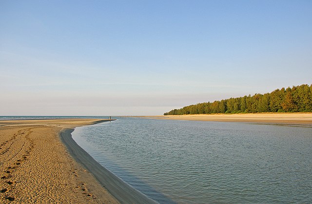
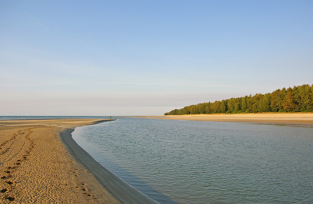
English: Estuary mouth of Sandy Creek at low tide. Casuarina Coastal Reserve in Darwin, Northern Territory, Australia.
Français : Un estuaire à marée basse. Réserve naturelle côtière de Casuarina, Darwin,
Territoire du Nord, Australie. |
| Date | |
| Source | Own work |
| Author | Bidgee |
| Permission ( Reusing this file) |
I, the copyright holder of this work, hereby publish it under the following license: This file is licensed under the
Creative Commons
Attribution 3.0 Unported license.
|
| Camera location |
| View this and other nearby images on: OpenStreetMap |
|
|---|
This image has been assessed using the
Quality image guidelines and is considered a
Quality image.
|
| Annotations | This image is annotated: View the annotations at Commons |
File history
Click on a date/time to view the file as it appeared at that time.
| Date/Time | Thumbnail | Dimensions | User | Comment | |
|---|---|---|---|---|---|
| current | 22:37, 10 June 2008 |
| 2,024 × 1,323 (661 KB) | Dschwen | rotated 0.89deg CCW |
| 01:59, 17 May 2008 |
 | 2,048 × 1,362 (731 KB) | Bidgee | {{Information |Description=Estuary mouth. Darwin, Northern Territory |Source=self-made |Date=8th September 2007 |Author= Bidgee |Permission= |other_versions= }} Category:Darwin, Northern Territory Category:Estuaries in Australia |
File usage
The following pages on the English Wikipedia use this file (pages on other projects are not listed):
Global file usage
The following other wikis use this file:
- Usage on fr.wikipedia.org
- Usage on gl.wikipedia.org
- Usage on sl.wikipedia.org
- Usage on www.wikidata.org