
Original file (3,010 × 2,085 pixels, file size: 4.12 MB, MIME type: image/jpeg)
| This is a file from the
Wikimedia Commons. Information from its
description page there is shown below. Commons is a freely licensed media file repository. You can help. |
.jpg)
Summary
| Description |
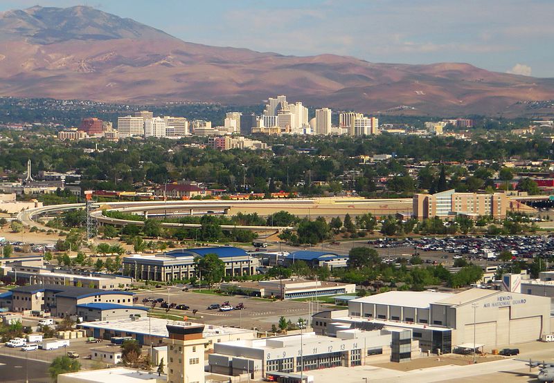
Reno is a city in the US state of Nevada. Known as "The Biggest Little City in the World", Reno is famous for its casinos and as the birthplace of Caesars Entertainment Corporation. The city is situated in the northwestern part of the state and is the county seat of Washoe County. Reno is the most populous Nevada city outside of the Las Vegas metropolitan area. As of the 2010 census, the city had a population of 225,221 making it the fourth most populous city in the state after Las Vegas, Henderson, and North Las Vegas. The city sits in a high desert at the foot of the Sierra Nevada and its downtown area (along with Sparks) occupies a valley informally known as the Truckee Meadows. Reno is part of the Reno–Sparks metropolitan area which consists of all of both Washoe and Storey counties and has a 2013 estimated population of 437,673. making it the second largest metropolitan area in Nevada. en.wikipedia.org/wiki/Reno,_Nevada en.wikipedia.org/wiki/Wikipedia:Text_of_Creative_Commons_... |
| Date | Taken on 25 May 2015, 08:54 |
| Source | Downtown Reno, Nevada |
| Author | Ken Lund from Reno, Nevada, USA |
| Camera location |
| View this and other nearby images on: OpenStreetMap |
|
|---|
.jpg¶ms=039.496014_N_-119.771595_E_globe:Earth_type:camera_source:Flickr_&language=en)
Licensing
- You are free:
- to share – to copy, distribute and transmit the work
- to remix – to adapt the work
- Under the following conditions:
- attribution – You must give appropriate credit, provide a link to the license, and indicate if changes were made. You may do so in any reasonable manner, but not in any way that suggests the licensor endorses you or your use.
- share alike – If you remix, transform, or build upon the material, you must distribute your contributions under the same or compatible license as the original.
| This image was originally posted to Flickr by Ken Lund at https://flickr.com/photos/75683070@N00/17573535294. It was reviewed on 4 December 2015 by FlickreviewR and was confirmed to be licensed under the terms of the cc-by-sa-2.0. |
File history
Click on a date/time to view the file as it appeared at that time.
| Date/Time | Thumbnail | Dimensions | User | Comment | |
|---|---|---|---|---|---|
| current | 04:30, 4 December 2015 |
| 3,010 × 2,085 (4.12 MB) | INeverCry | Transferred from Flickr via Flickr2Commons |
File usage
Global file usage
The following other wikis use this file:
.jpg)