
Original file (3,012 × 2,180 pixels, file size: 1.64 MB, MIME type: image/jpeg)
| This is a file from the
Wikimedia Commons. Information from its
description page there is shown below. Commons is a freely licensed media file repository. You can help. |
| Description |
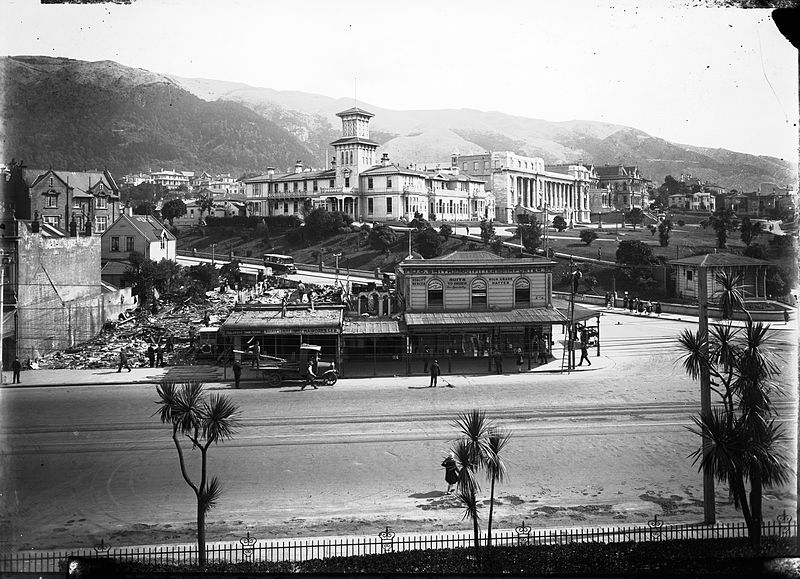
Wooden buildings are being demolished to make way for the construction of the Cenotaph. Government House, Parliament Buildings and Turnbull House are in the background. Photographer: Unknown (Wellington City Council archive reference: 00155:0:44) When the picture was taken, Bowen Street met with Lambton Quay about 60 metres north-east of where it is now - on the other side of the Cenotaph. The intersection was changed in the late 1930s as part of the work to extend Bowen Street to Tinakori Road, to help ease traffic congestion and shorten the route between the central city and Karori. The original end to Bowen Street existed until the early 1970s, when it was landscaped into the paved park between the Cenotaph and the gates to the Parliament grounds. |
||
| Date | |||
| Source | Flickr: Corner of Bowen Street and Lambton Quay, circa 1929 | ||
| Author | Wellington City Council | ||
| Permission ( Reusing this file) |
This file is licensed under the
Creative Commons
Attribution-Share Alike 2.0 Generic license.
|
| Annotations | This image is annotated: View the annotations at Commons |
File history
Click on a date/time to view the file as it appeared at that time.
| Date/Time | Thumbnail | Dimensions | User | Comment | |
|---|---|---|---|---|---|
| current | 19:22, 22 May 2014 |
| 3,012 × 2,180 (1.64 MB) | Flickr upload bot | Uploaded from http://flickr.com/photo/50247176@N03/4839368045 using Flickr upload bot |
File usage
Global file usage
The following other wikis use this file:
- Usage on ca.wikipedia.org
- Usage on sl.wikipedia.org