No higher resolution available.
Co-op_City_Hutch_River_crop.jpg (375 × 179 pixels, file size: 28 KB, MIME type: image/jpeg)
| This is a file from the
Wikimedia Commons. Information from its
description page there is shown below. Commons is a freely licensed media file repository. You can help. |
Summary
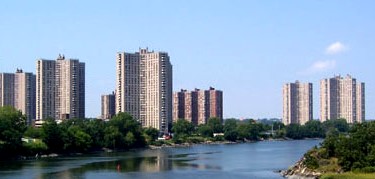
| Description |
English: Co-op City sits along the Hutchinson River. |
| Date | |
| Source | Transferred from en.wikipedia to Commons. |
| Author | Sacme at English Wikipedia; cropped by Beyond My Ken ( talk) 07:42, 10 September 2013 (UTC) |
| Other versions |
| Camera location | | View this and other nearby images on: OpenStreetMap |
|
|---|
Licensing
Sacme at
English Wikipedia, the copyright holder of this work, hereby publishes it under the following licenses:

|
Permission is granted to copy, distribute and/or modify this document under the terms of the GNU Free Documentation License, Version 1.2 or any later version published by the Free Software Foundation; with no Invariant Sections, no Front-Cover Texts, and no Back-Cover Texts. A copy of the license is included in the section entitled GNU Free Documentation License. |
This file is licensed under the
Creative Commons
Attribution 3.0 Unported license.
Attribution:
Sacme at
English Wikipedia
- You are free:
- to share – to copy, distribute and transmit the work
- to remix – to adapt the work
- Under the following conditions:
- attribution – You must give appropriate credit, provide a link to the license, and indicate if changes were made. You may do so in any reasonable manner, but not in any way that suggests the licensor endorses you or your use.
You may select the license of your choice.
Original upload log
The original description page was
here. All following user names refer to en.wikipedia.
- 2007-10-29 03:55 Sacme 575×257×8 (41555 bytes) Co-op City sits along the Hutchinson River
- 2007-10-29 03:33 Sacme 575×257×8 (41526 bytes) Co-op City sits along the Hutchinson River
- 2007-10-29 03:17 Sacme 576×432×8 (50349 bytes) Co-op City sits along the Hutchinson River.
File history
Click on a date/time to view the file as it appeared at that time.
| Date/Time | Thumbnail | Dimensions | User | Comment | |
|---|---|---|---|---|---|
| current | 07:42, 10 September 2013 |
| 375 × 179 (28 KB) | Beyond My Ken | {{Information |Description={{en|Co-op City sits along the Hutchinson River.}} |Source=Transferred from [http://en.wikipedia.org en.wikipedia] |Date=2007-09-03 |Author=Original uploader was Sacme at [http://en.wikipedia.org en.wikiped... |
File usage
The following pages on the English Wikipedia use this file (pages on other projects are not listed):
Global file usage
The following other wikis use this file:
- Usage on ar.wikipedia.org