
Size of this preview:
800 × 599 pixels. Other resolutions:
320 × 240 pixels |
640 × 479 pixels |
1,024 × 767 pixels |
1,280 × 958 pixels |
2,560 × 1,917 pixels |
2,932 × 2,195 pixels.
Original file (2,932 × 2,195 pixels, file size: 2.66 MB, MIME type: image/jpeg)
| This is a file from the
Wikimedia Commons. Information from its
description page there is shown below. Commons is a freely licensed media file repository. You can help. |
Summary
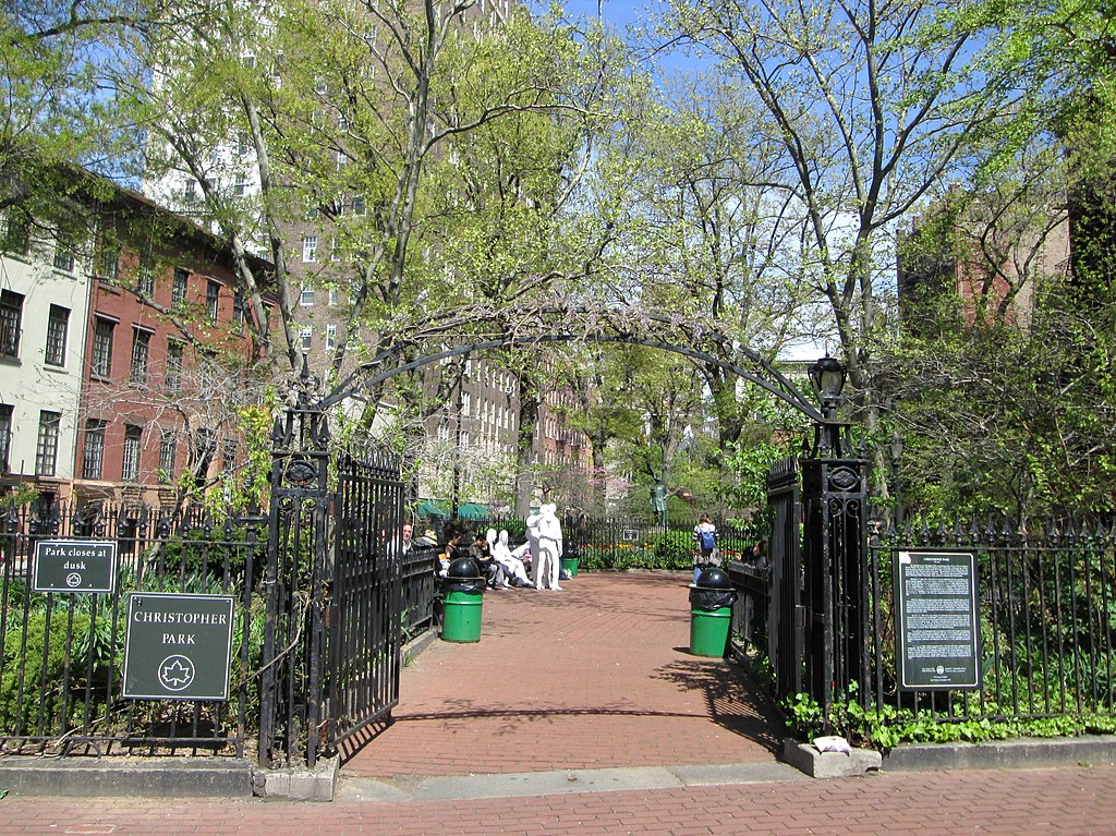
| Description | Christopher Park, located in Sheridan Square in the triangle formed by Christopher, Grove and West 4th Streets in the Greenwich Village neighborhood of Manhattan, New York City, was created on April 5, 1837 after the city condemned property which had been destroyed by fire two years earlier. A restoration of the park was undertaken by the Friends of Christopher Park beginning in 1983, supervised by the landscape architect Paul Winslow, and costing $130,000. The park re-opened in 1986. In 1992 George Segal's statue Gay Liberation was installed in the park. (Source: "Christopher Park" on the NYC Department of Parks & Recreation website) |
| Date | |
| Source | Own work |
| Author | Beyond My Ken |
| Camera location | | View this and other nearby images on: OpenStreetMap |
|
|---|
Licensing
I, the copyright holder of this work, hereby publish it under the following licenses:

|
Permission is granted to copy, distribute and/or modify this document under the terms of the GNU Free Documentation License, Version 1.2 or any later version published by the Free Software Foundation; with no Invariant Sections, no Front-Cover Texts, and no Back-Cover Texts. A copy of the license is included in the section entitled GNU Free Documentation License. |
This file is licensed under the
Creative Commons Attribution-Share Alike
4.0 International,
3.0 Unported,
2.5 Generic,
2.0 Generic and
1.0 Generic license.
- You are free:
- to share – to copy, distribute and transmit the work
- to remix – to adapt the work
- Under the following conditions:
- attribution – You must give appropriate credit, provide a link to the license, and indicate if changes were made. You may do so in any reasonable manner, but not in any way that suggests the licensor endorses you or your use.
- share alike – If you remix, transform, or build upon the material, you must distribute your contributions under the same or compatible license as the original.
You may select the license of your choice.
File history
Click on a date/time to view the file as it appeared at that time.
| Date/Time | Thumbnail | Dimensions | User | Comment | |
|---|---|---|---|---|---|
| current | 05:01, 2 July 2013 |
| 2,932 × 2,195 (2.66 MB) | Beyond My Ken | == {{int:filedesc}} == {{Information |Description= '''Christopher Park''', located in Sheridan Square in the triangle formed by Christopher, Grove and West 4th Streets in the Greenwich Village neighborhood of Manhattan, New York City, was created on Ap... |
File usage
The following pages on the English Wikipedia use this file (pages on other projects are not listed):
Global file usage
The following other wikis use this file:
- Usage on de.wikipedia.org
- Usage on en.wikivoyage.org
- Usage on es.wikipedia.org
- Usage on pt.wikipedia.org
- Usage on ru.wikipedia.org
- Usage on www.wikidata.org