
Size of this preview:
800 × 531 pixels. Other resolutions:
320 × 213 pixels |
640 × 425 pixels |
1,024 × 680 pixels |
1,280 × 850 pixels |
2,560 × 1,700 pixels |
3,216 × 2,136 pixels.
Original file (3,216 × 2,136 pixels, file size: 1.57 MB, MIME type: image/jpeg)
| This is a file from the
Wikimedia Commons. Information from its
description page there is shown below. Commons is a freely licensed media file repository. You can help. |
Summary
| Camera location |
| View this and other nearby images on: OpenStreetMap |
|
|---|
| Description |
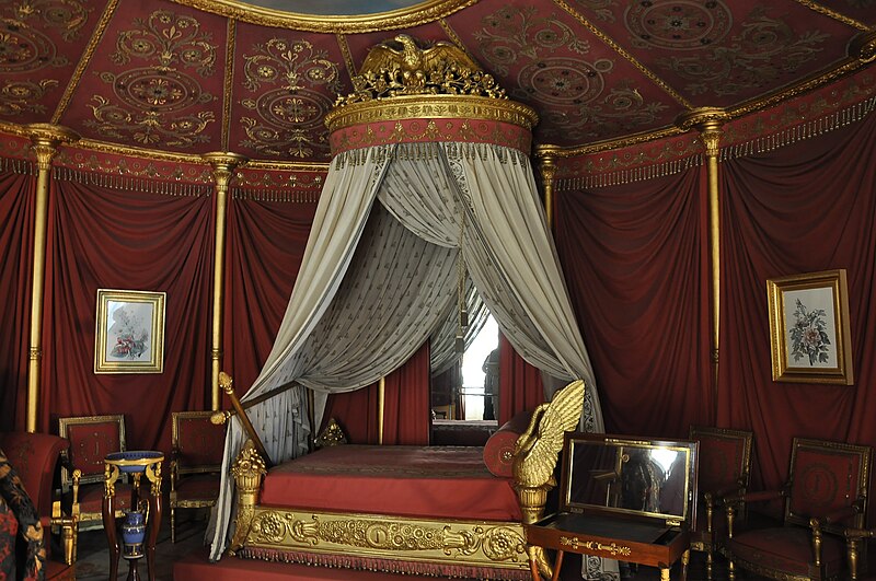
Français : L'appartement de l'impératrice Joséphine au Château de Malmaison à Rueil-Malmaison dans les Hauts-de-Seine en France. Installé en 1800 dans la partie nord du château, cet appartement que le couple consulaire partagea pendant plusieurs années resta à l'usage exclusif de Joséphine après 1803. La chambre de l'Impératrice, somptueusement réaménagée en 1812 en forme d'une tente à seize pans garde aujourd'hui son lit en bois doré d'origine (1812) exécuté par l'atelier Jacob-Desmalter & Cie (1770-1841). - Lit à baldaquin. Lit de travers à double tombeau.
English: The apartment of empress Joséphine in the Château de Malmaison in Rueil-Malmaison, France. Installed in 1800 in the north part of the Château, this apartment which the consular couple shared during several years stayed in the Joséphine's exclusive usage after 1803. The room of the Empress, luxuriously decorated in 1812 in the shape of a tent with sixteen pieces, exhibits the original bed. |
| Date | |
| Source | Own work |
| Author | Moonik |
Licensing
I, the copyright holder of this work, hereby publish it under the following license:
This file is licensed under the
Creative Commons
Attribution-Share Alike 3.0 Unported license.
- You are free:
- to share – to copy, distribute and transmit the work
- to remix – to adapt the work
- Under the following conditions:
- attribution – You must give appropriate credit, provide a link to the license, and indicate if changes were made. You may do so in any reasonable manner, but not in any way that suggests the licensor endorses you or your use.
- share alike – If you remix, transform, or build upon the material, you must distribute your contributions under the same or compatible license as the original.
File history
Click on a date/time to view the file as it appeared at that time.
| Date/Time | Thumbnail | Dimensions | User | Comment | |
|---|---|---|---|---|---|
| current | 15:01, 9 December 2011 |
| 3,216 × 2,136 (1.57 MB) | Moonik |
File usage
The following pages on the English Wikipedia use this file (pages on other projects are not listed):
Global file usage
The following other wikis use this file:
- Usage on ar.wikipedia.org
- Usage on az.wikipedia.org
- Usage on el.wikipedia.org
- Usage on eo.wikipedia.org
- Usage on fa.wikipedia.org
- Usage on fi.wikipedia.org
- Usage on fr.wikipedia.org
- Usage on hak.wikipedia.org
- Usage on hy.wikipedia.org
- Usage on mk.wikipedia.org
- Usage on nn.wikipedia.org
- Usage on pl.wikipedia.org
- Usage on ru.wikipedia.org
- Usage on simple.wikipedia.org
- Usage on sq.wikipedia.org