Size of this preview:
800 × 438 pixels. Other resolutions:
320 × 175 pixels |
640 × 351 pixels |
1,024 × 561 pixels |
1,280 × 701 pixels |
2,989 × 1,637 pixels.
Original file (2,989 × 1,637 pixels, file size: 2.05 MB, MIME type: image/jpeg)
| This is a file from the
Wikimedia Commons. Information from its
description page there is shown below. Commons is a freely licensed media file repository. You can help. |
|
This is an image of a place or building that is listed on the
National Register of Historic Places in the
United States of America. Its reference number is
82001189. |
| Description |
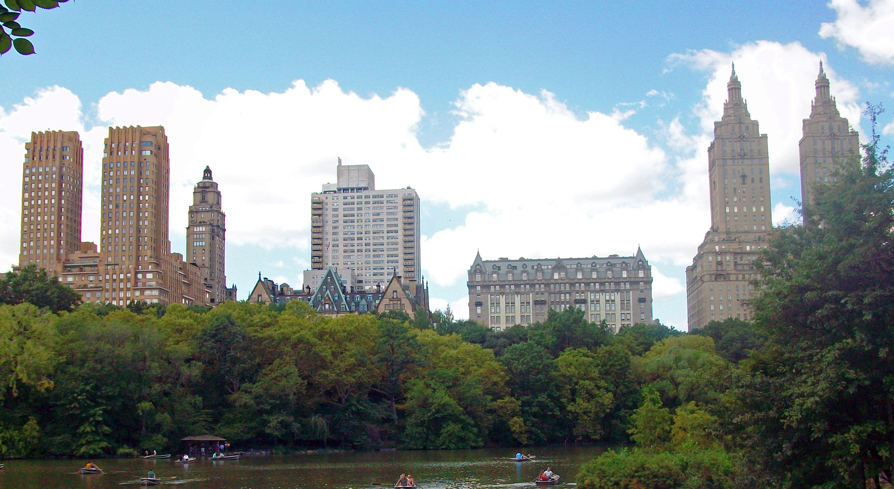
English: The
Majestic,
Dakota,
Langham and
San Remo, all
contributing properties to the
Central Park West Historic District, seen from Bow Bridge over the
Lake in Central Park |
||
| Date | Taken on 13 September 2009 | ||
| Source | Own work | ||
| Author | Daniel Case; cropped by Beyond My Ken ( talk) 07:35, 10 September 2013 (UTC) | ||
| Permission ( Reusing this file) |
I, the copyright holder of this work, hereby publish it under the following licenses: This file is licensed under the
Creative Commons
Attribution-Share Alike 3.0 Unported license.
You may select the license of your choice. |
||
| Other versions |


| Object location |
| View this and other nearby images on: OpenStreetMap |
|
|---|
File history
Click on a date/time to view the file as it appeared at that time.
| Date/Time | Thumbnail | Dimensions | User | Comment | |
|---|---|---|---|---|---|
| current | 07:35, 10 September 2013 |
| 2,989 × 1,637 (2.05 MB) | Beyond My Ken | {{NRHP|82001189}} {{Information |Description={{en|1=The Majestic, Dakota, Langham and San Remo, all contributing properties to the [[w:Central P... |
File usage
The following pages on the English Wikipedia use this file (pages on other projects are not listed):
Global file usage
The following other wikis use this file:
- Usage on ar.wikipedia.org
- Usage on zh.wikipedia.org