
Size of this preview:
800 × 600 pixels. Other resolutions:
320 × 240 pixels |
640 × 480 pixels |
1,024 × 768 pixels |
1,280 × 960 pixels |
2,560 × 1,920 pixels |
3,264 × 2,448 pixels.
Original file (3,264 × 2,448 pixels, file size: 2.46 MB, MIME type: image/jpeg)
| This is a file from the
Wikimedia Commons. Information from its
description page there is shown below. Commons is a freely licensed media file repository. You can help. |
Summary
| Description |
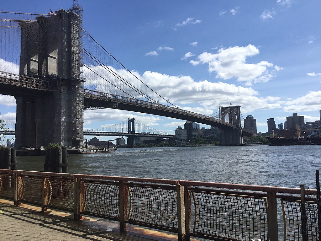
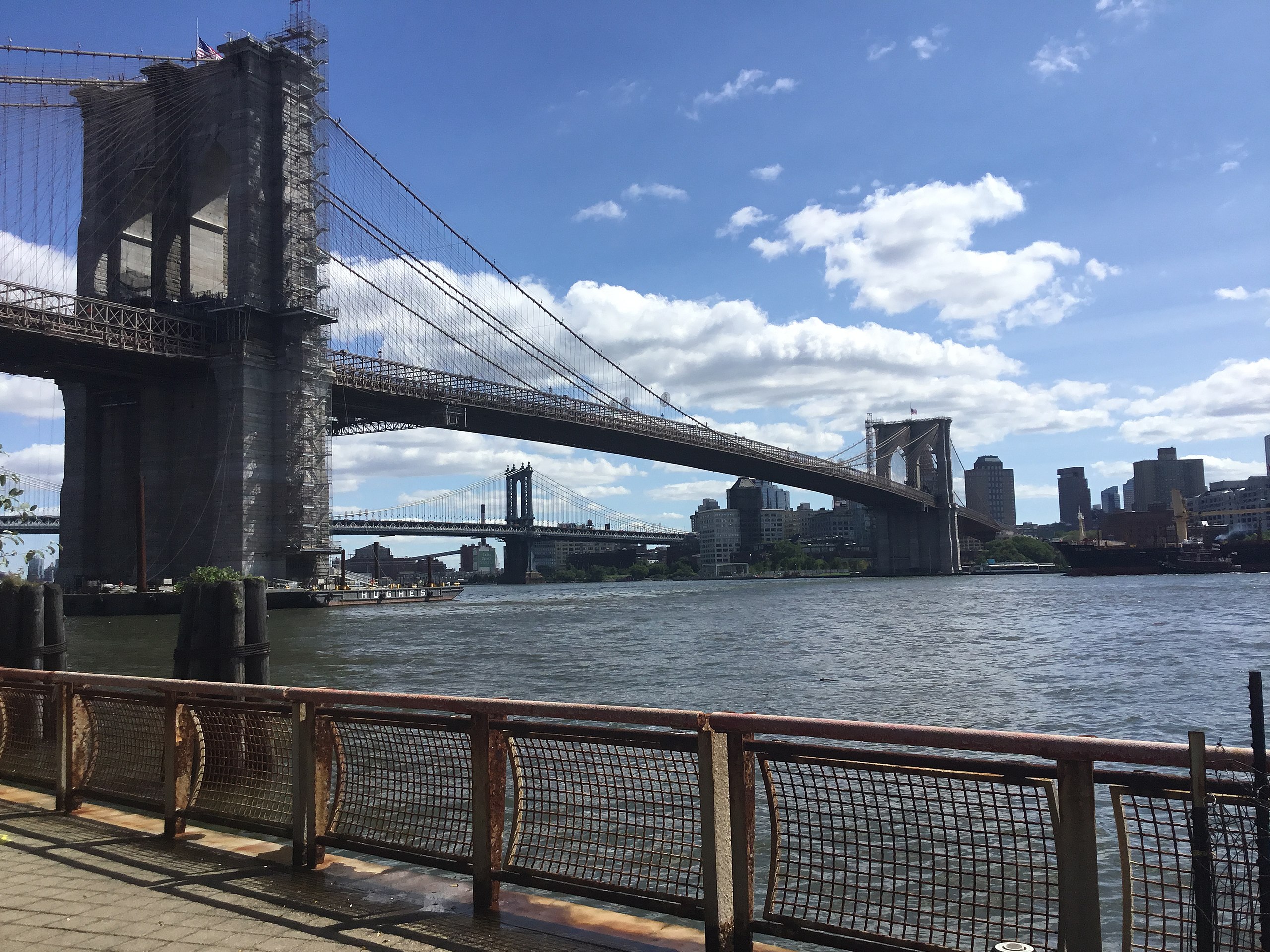
English: The Brooklyn Bridge seen in September 2021 |
| Date | |
| Source | Own work |
| Author | Kidfly182 |
| Camera location | | View this and other nearby images on: OpenStreetMap |
|
|---|
Licensing
I, the copyright holder of this work, hereby publish it under the following license:
This file is licensed under the
Creative Commons
Attribution-Share Alike 4.0 International license.
- You are free:
- to share – to copy, distribute and transmit the work
- to remix – to adapt the work
- Under the following conditions:
- attribution – You must give appropriate credit, provide a link to the license, and indicate if changes were made. You may do so in any reasonable manner, but not in any way that suggests the licensor endorses you or your use.
- share alike – If you remix, transform, or build upon the material, you must distribute your contributions under the same or compatible license as the original.
File history
Click on a date/time to view the file as it appeared at that time.
| Date/Time | Thumbnail | Dimensions | User | Comment | |
|---|---|---|---|---|---|
| current | 08:47, 26 September 2021 |
| 3,264 × 2,448 (2.46 MB) | Kidfly182 | Uploaded own work with UploadWizard |
File usage
More than 100 pages use this file. The following list shows the first 100 pages that use this file only. A full list is available.
- Arch bridge
- Bascule bridge
- Beam bridge
- Box girder bridge
- Bridge
- Bridge to nowhere
- Bridges in art
- Bridge–tunnel
- Burr Truss
- Cable-stayed bridge
- Cantilever bridge
- Cantilever spar cable-stayed bridge
- Canton Viaduct
- Covered bridge
- Drawbridge
- Extradosed bridge
- Folding bridge
- Girder bridge
- Guthrie rolling bridge
- Hangzhou Bay Bridge
- I-35W Mississippi River bridge
- Jet bridge
- Jintang Bridge
- Lake Pontchartrain Causeway
- List of bascule bridges
- List of bridge failures
- List of bridges
- List of bridges in Afghanistan
- List of bridges in Andorra
- List of bridges in Bosnia and Herzegovina
- List of bridges in Canada
- List of bridges in China
- List of bridges in Denmark
- List of bridges in Finland
- List of bridges in Greece
- List of bridges in Hungary
- List of bridges in India
- List of bridges in Montenegro
- List of bridges in Myanmar
- List of bridges in Norway
- List of bridges in Pakistan
- List of bridges in Portugal
- List of bridges in Serbia
- List of bridges in Slovenia
- List of bridges in South Korea
- List of bridges in Spain
- List of bridges in Sweden
- List of bridges in Switzerland
- List of bridges in Tanzania
- List of bridges in Thailand
- List of bridges in Turkey
- List of bridges in the Philippines
- List of bridges in the Republic of Ireland
- List of bridges in the United States by height
- List of bridge–tunnels
- List of cantilever bridges
- List of highest bridges
- List of longest arch bridge spans
- List of longest bridges
- List of longest cable-stayed bridge spans
- List of longest cantilever bridge spans
- List of longest continuous truss bridge spans
- List of longest masonry arch bridge spans
- List of longest suspension bridge spans
- List of medieval stone bridges in Germany
- List of multi-level bridges
- List of road–rail bridges
- List of tallest bridges
- List of toll bridges
- Log bridge
- Low-water crossing
- Moon bridge
- Moveable bridge
- Multi-way bridge
- Navigable aqueduct
- Pile bridge
- Plate girder bridge
- Pontoon bridge
- Retractable bridge
- Segmental bridge
- Self-anchored suspension bridge
- Side-spar cable-stayed bridge
- Simple suspension bridge
- Stressed ribbon bridge
- Submersible bridge
- Suspension bridge
- Swing bridge
- Symphony bridge
- Table bridge
- Through arch bridge
- Tilt bridge
- Timber bridge
- Transporter bridge
- Trestle bridge
- Truss bridge
- Tubular bridge
- Types of suspension bridges
- Underspanned suspension bridge
- Vertical-lift bridge
- Viaduct
View more links to this file.
Global file usage
The following other wikis use this file:
- Usage on si.wikipedia.org