
Size of this preview:
800 × 497 pixels. Other resolutions:
320 × 199 pixels |
640 × 398 pixels |
1,024 × 636 pixels |
1,280 × 795 pixels |
2,286 × 1,420 pixels.
Original file (2,286 × 1,420 pixels, file size: 1.18 MB, MIME type: image/jpeg)
| This is a file from the
Wikimedia Commons. Information from its
description page there is shown below. Commons is a freely licensed media file repository. You can help. |
Summary
| Description | |
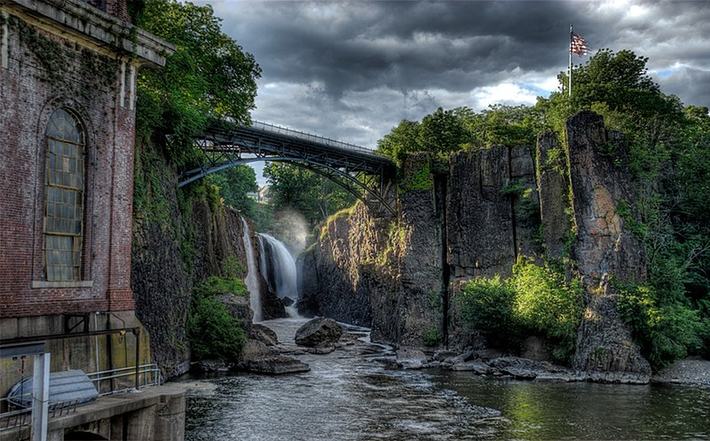
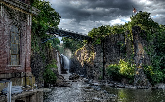
| Date | |
| Source |
Own work Modifications from the original upload: watermark removed, downsampled (the original upload was heavily oversampled), a fence at bottom cropped out. |
| Author | Merle9999 |
| Permission ( Reusing this file) |
Removed watermark:
|
| Camera location | | View this and other nearby images on: OpenStreetMap |
|
|---|

|
Attribution information, such as the author's name, e-mail, website, or signature, that was once visible in the image itself has been moved into the image metadata and/or image description page. This makes the image easier to reuse and more language-neutral, and makes the text easier to process and search for. Commons
discourages placing visible author information in images.
|
Licensing
I, the copyright holder of this work, hereby publish it under the following licenses:
This file is licensed under the
Creative Commons
Attribution-Share Alike 3.0 Unported license.
- You are free:
- to share – to copy, distribute and transmit the work
- to remix – to adapt the work
- Under the following conditions:
- attribution – You must give appropriate credit, provide a link to the license, and indicate if changes were made. You may do so in any reasonable manner, but not in any way that suggests the licensor endorses you or your use.
- share alike – If you remix, transform, or build upon the material, you must distribute your contributions under the same or compatible license as the original.

|
Permission is granted to copy, distribute and/or modify this document under the terms of the GNU Free Documentation License, Version 1.2 or any later version published by the Free Software Foundation; with no Invariant Sections, no Front-Cover Texts, and no Back-Cover Texts. A copy of the license is included in the section entitled GNU Free Documentation License. |
You may select the license of your choice.
File history
Click on a date/time to view the file as it appeared at that time.
| Date/Time | Thumbnail | Dimensions | User | Comment | |
|---|---|---|---|---|---|
| current | 06:28, 18 June 2010 |
| 2,286 × 1,420 (1.18 MB) | Cropbot | upload cropped version, operated by User:Trycatch. Summary: distracting fence cropped out |
| 02:24, 14 June 2010 |
 | 2,286 × 1,528 (1.2 MB) | Trycatch | removed watermark: "Merle Allen Photography http://web.me.com/merle9999"; the file was for some reason heavily upscaled, i've changed the resolution to 0.25x of the original and it's still upscaled | |
| 13:17, 9 July 2009 |
 | 4,572 × 3,055 (5.12 MB) | Merle9999 | {{Information |Description={{en|1=The Great Falls of Paterson New Jersey}} |Source=Own work by uploader |Author= Merle9999 |Date=2009-07-08 |Permission= |other_versions= }} |
File usage
The following pages on the English Wikipedia use this file (pages on other projects are not listed):
Global file usage
The following other wikis use this file:
- Usage on el.wikipedia.org
- Usage on en.wikivoyage.org
- Usage on fa.wikipedia.org
- Usage on fr.wikipedia.org
- Usage on fy.wikipedia.org
- Usage on hsb.wikipedia.org
- Usage on ie.wikipedia.org
- Usage on ja.wikipedia.org
- Usage on lb.wikipedia.org
- Usage on sk.wikipedia.org