Size of this preview:
800 × 557 pixels. Other resolutions:
320 × 223 pixels |
640 × 445 pixels |
1,052 × 732 pixels.
Original file (1,052 × 732 pixels, file size: 1.19 MB, MIME type: image/jpeg)
| This is a file from the
Wikimedia Commons. Information from its
description page there is shown below. Commons is a freely licensed media file repository. You can help. |
Summary
| Description |
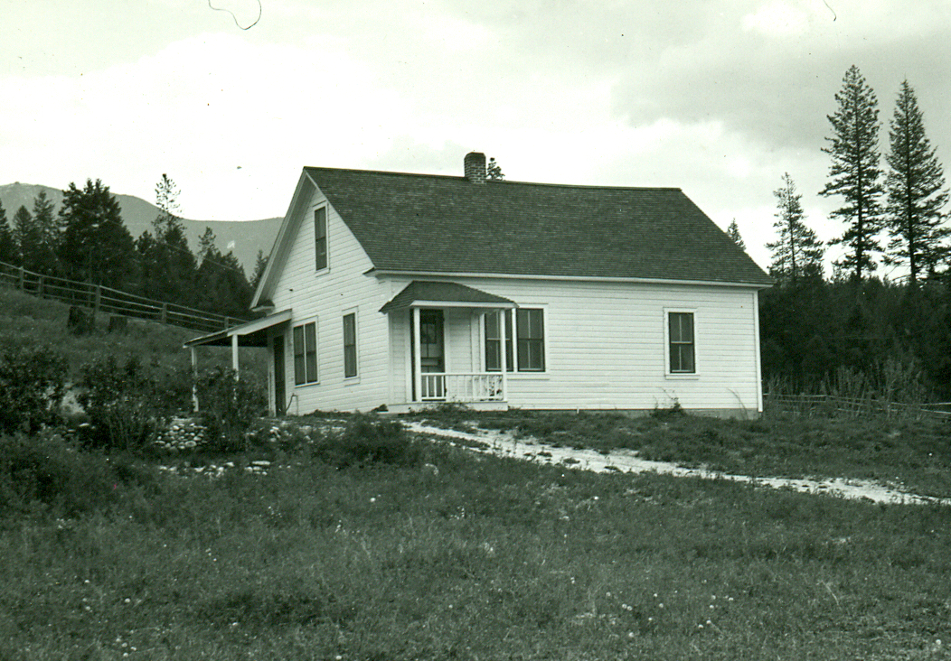
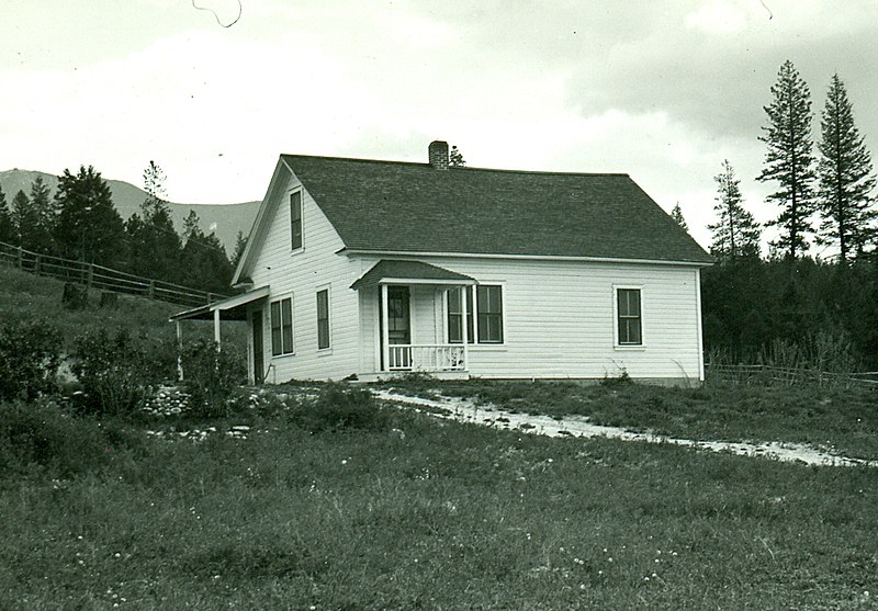
English: The ranger's residence at the Ant Flat Ranger Station, Kootenai National Forest, Fortine, Montana. This building was destroyed in the 1950s or 1960s.
|
||
| Date | |||
| Source | USFS via Flickr: https://www.flickr.com/photos/40882383@N03/5840676416/in/photolist-9U7ZBw-7cqkj | ||
| Author | USFS photo |
Licensing
This image is a work of the
Forest Service of the
United States Department of Agriculture. As a
work of the
U.S. federal government, the image is in the
public domain.
|
| This image, originally posted to Flickr, was reviewed on 27 October 2017 by the administrator or reviewer Elisfkc, who confirmed that it was available on Flickr under the stated license on that date. |
File history
Click on a date/time to view the file as it appeared at that time.
| Date/Time | Thumbnail | Dimensions | User | Comment | |
|---|---|---|---|---|---|
| current | 03:12, 17 November 2013 |
| 1,052 × 732 (1.19 MB) | Magicpiano | {{Information |Description=The ranger's residence at the Ant Flat Ranger Station, Kootenai National Forest, Fortine, Montana. |Source=USFS via Flickr: http://www.flickr.com/photos/40882383@N03/5840676416/in/photolist-9U7ZBw-7cqkj |Date=1935 |Author=USF... |
File usage
The following pages on the English Wikipedia use this file (pages on other projects are not listed):
Global file usage
The following other wikis use this file:
- Usage on www.wikidata.org