Size of this preview:
776 × 600 pixels. Other resolutions:
311 × 240 pixels |
621 × 480 pixels |
994 × 768 pixels |
1,280 × 989 pixels |
2,112 × 1,632 pixels.
Original file (2,112 × 1,632 pixels, file size: 36 KB, MIME type: image/png)
| This is a file from the
Wikimedia Commons. Information from its
description page there is shown below. Commons is a freely licensed media file repository. You can help. |

|
This map image could be re-created using
vector graphics as an
SVG file. This has several advantages; see
Commons:Media for cleanup for more information. If an SVG form of this image is available, please upload it and afterwards replace this template with
{{
vector version available|new image name}}
.
It is recommended to name the SVG file “American Samoa Districts.svg”—then the template Vector version available (or Vva) does not need the new image name parameter. |
Summary
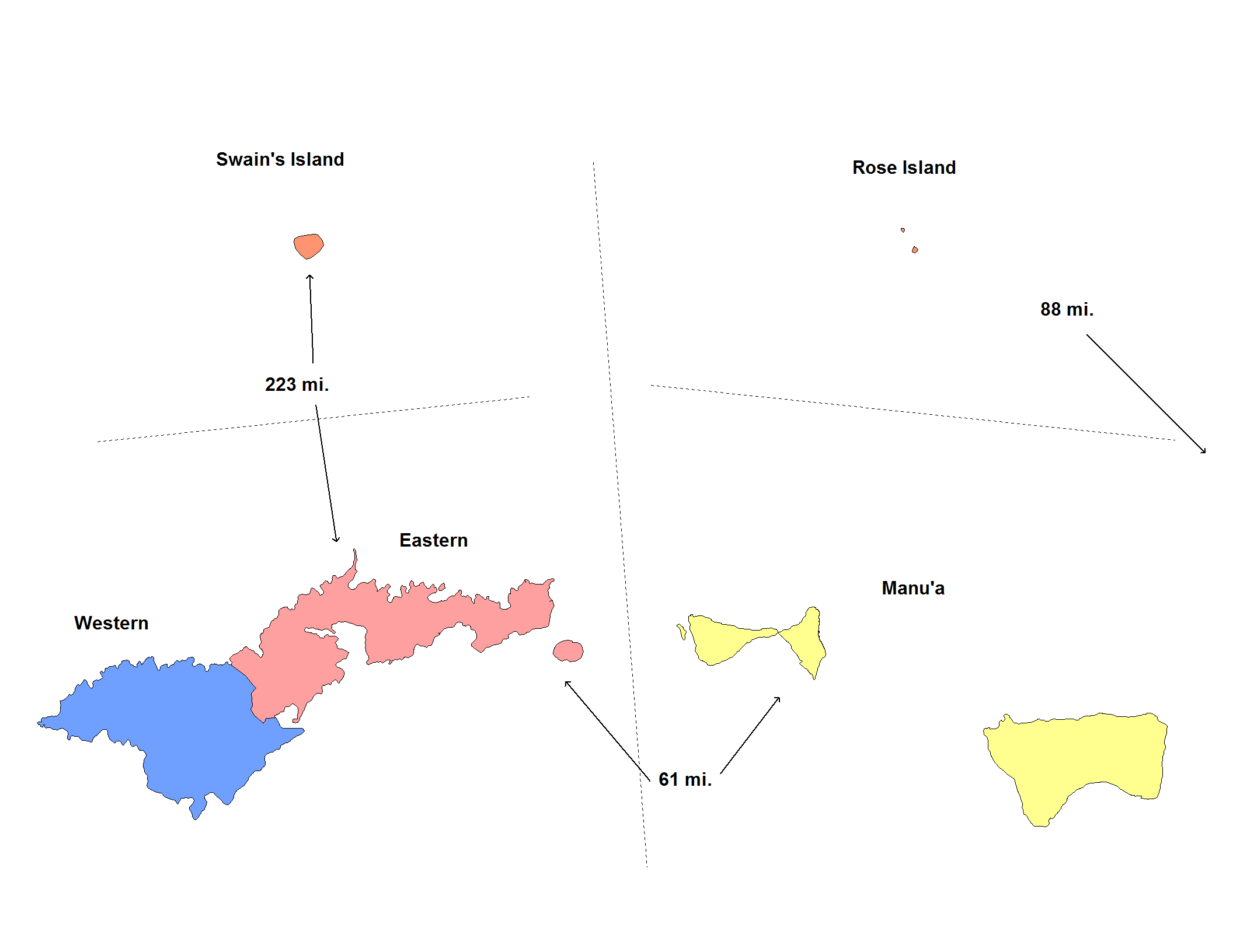
| Description | Map of the districts of American Samoa. Created by Rarelibra for public domain use. Created using MapInfo Professional v7.5 and various mapping resources. |
| Date | 20 November 2006 (original upload date) |
| Source | No machine-readable source provided. Own work assumed (based on copyright claims). |
| Author | No machine-readable author provided. Electionworld assumed (based on copyright claims). |
Licensing
| I, the copyright holder of this work, release this work into the
public domain. This applies worldwide. In some countries this may not be legally possible; if so: I grant anyone the right to use this work for any purpose, without any conditions, unless such conditions are required by law. |
File history
Click on a date/time to view the file as it appeared at that time.
| Date/Time | Thumbnail | Dimensions | User | Comment | |
|---|---|---|---|---|---|
| current | 05:14, 1 June 2020 |
| 2,112 × 1,632 (36 KB) | Heitordp | Reverted to version as of 17:42, 11 January 2008 (UTC) keep previous map, many articles refer to its colors and positions |
| 03:32, 1 June 2020 |
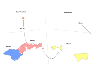
| 2,104 × 808 (26 KB) | Heitordp | Removed excessive blank space, removed distances, improved shapes, moved islands to reflect real relative positions, adjusted colors, corrected atoll names, increased font size for legibility in infobox | |
| 17:42, 11 January 2008 |
 | 2,112 × 1,632 (36 KB) | Rarelibra | update map | |
| 22:22, 20 November 2006 |
 | 953 × 598 (11 KB) | Electionworld | == Summary == Map of the districts of American Samoa. Created by Rarelibra for public domain use. Created using MapInfo Professional v7.5 and various mapping resources. == Licensing == {{PD-self}} Category:Maps of American Samoa |
File usage
The following pages on the English Wikipedia use this file (pages on other projects are not listed):
Global file usage
The following other wikis use this file:
- Usage on de.wikipedia.org
- Usage on eu.wikipedia.org
- Usage on fr.wikipedia.org
- Usage on fy.wikipedia.org
- Usage on he.wikipedia.org
- Usage on it.wikipedia.org
- Usage on ja.wikipedia.org
- Usage on ka.wikipedia.org
- Usage on nl.wikipedia.org
- Usage on os.wikipedia.org
- Usage on pt.wikipedia.org
- Usage on ru.wikipedia.org
- Usage on sm.wikipedia.org
- Usage on zh.wikipedia.org