Size of this JPG preview of this PDF file:
800 × 593 pixels. Other resolutions:
320 × 237 pixels |
640 × 475 pixels |
1,024 × 759 pixels |
1,280 × 949 pixels |
2,560 × 1,898 pixels |
6,675 × 4,950 pixels.
Original file (6,675 × 4,950 pixels, file size: 18.44 MB, MIME type: application/pdf)
| This is a file from the
Wikimedia Commons. Information from its
description page there is shown below. Commons is a freely licensed media file repository. You can help. |
| Description |
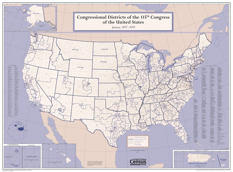
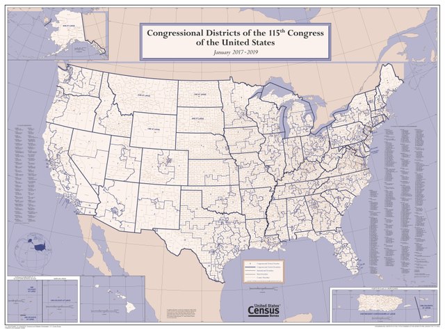
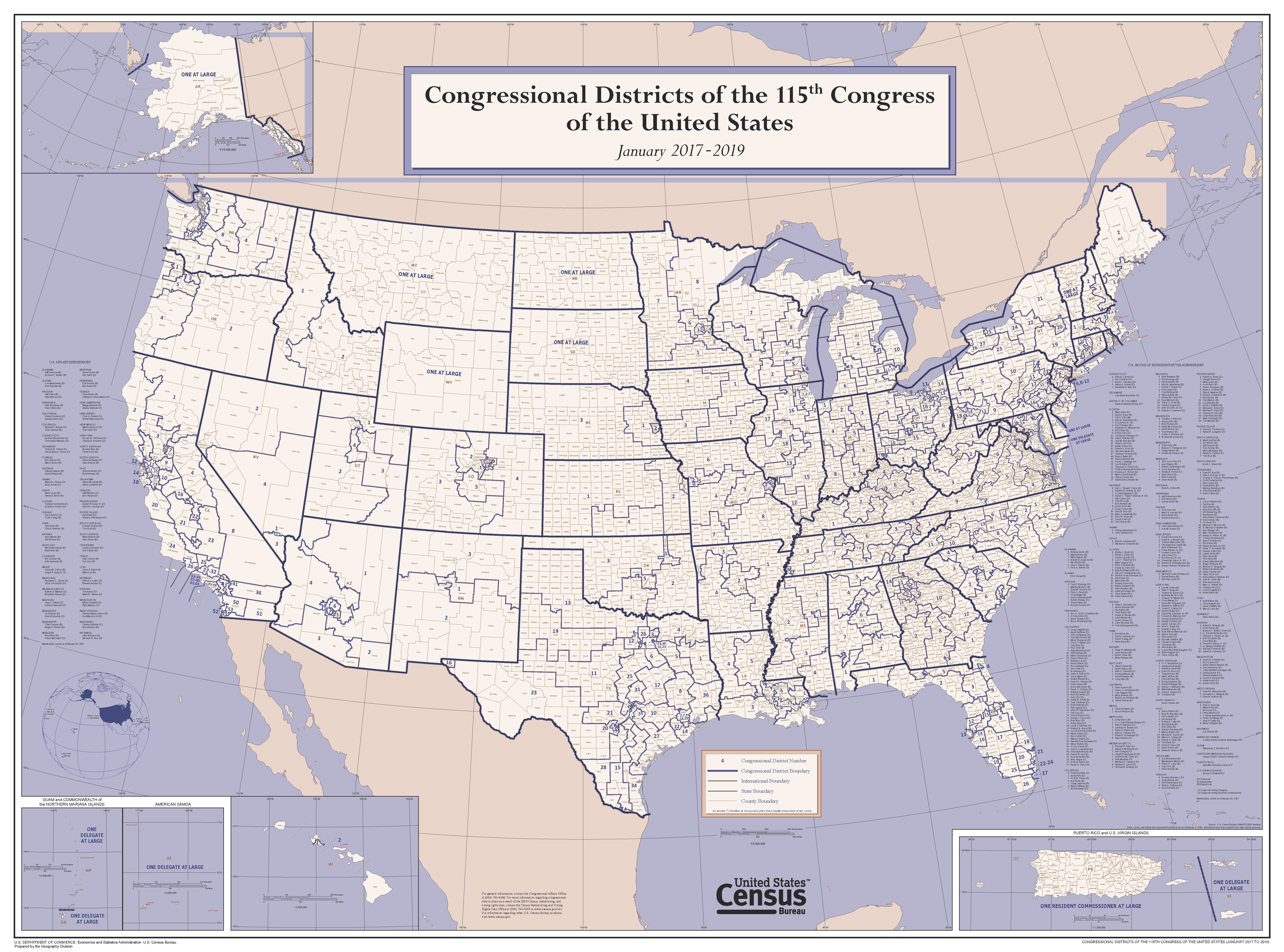
English: This wall map depicts congressional district boundaries in effect for the 115th Congress of the United States (January 2017-2019). The map includes county names and boundaries for each state, the District of Columbia, Puerto Rico, American Samoa, Guam, the Commonwealth of the Northern Mariana Islands, and U.S. Virgin Islands. The map also includes a listing of the names of all members of the 115th Congress, as of January 10, 2017. |
|||
| Date | ||||
| Source | https://www2.census.gov/geo/maps/cong_dist/uswall/cd115/CD115_US_WallMap.pdf | |||
| Author | U.S. Census Bureau | |||
| Permission ( Reusing this file) |
|

File history
Click on a date/time to view the file as it appeared at that time.
| Date/Time | Thumbnail | Dimensions | User | Comment | |
|---|---|---|---|---|---|
| current | 04:02, 27 September 2017 |
 | 6,675 × 4,950 (18.44 MB) | Kingofthedead | {{Information |Description ={{en|1=This wall map depicts congressional district boundaries in effect for the 115th Congress of the United States (January 2017-2019). The map includes county names and boundaries for each state, the District of Columb... |
File usage
The following pages on the English Wikipedia use this file (pages on other projects are not listed):
Global file usage
The following other wikis use this file:
- Usage on ar.wikipedia.org
- Usage on nl.wikipedia.org
- Usage on zh.wikipedia.org