Size of this preview:
788 × 600 pixels. Other resolutions:
315 × 240 pixels |
631 × 480 pixels |
1,010 × 769 pixels.
Original file (1,010 × 769 pixels, file size: 27 KB, MIME type: image/png)
| This is a file from the
Wikimedia Commons. Information from its
description page there is shown below. Commons is a freely licensed media file repository. You can help. |

|
This locator map image could be re-created using
vector graphics as an
SVG file. This has several advantages; see
Commons:Media for cleanup for more information. If an SVG form of this image is available, please upload it and afterwards replace this template with
{{
vector version available|new image name}}
.
It is recommended to name the SVG file “Şanlıurfa districts.svg”—then the template Vector version available (or Vva) does not need the new image name parameter. |
Summary
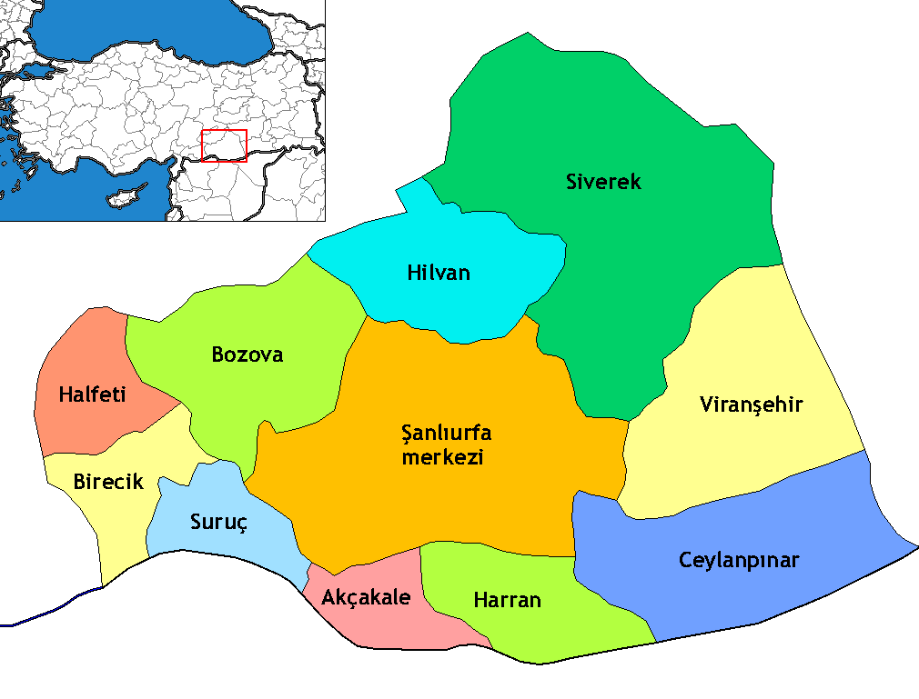
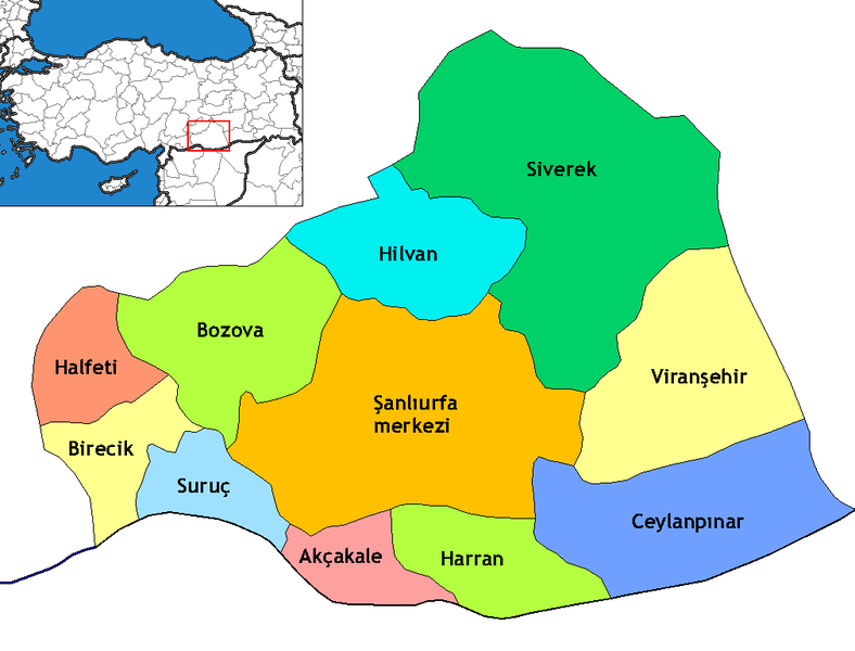
Map of the districts of Şanlıurfa province in Turkey. Created by Rarelibra 17:13, 4 December 2006 (UTC) for public domain use, using MapInfo Professional v8.5 and various mapping resources. Edited by One Homo Sapiens Corrected text where İ,Ş,ı,ğ,or ş occurs in name. Source: [statoids-com]. Increased font size and enhanced color differences among adjacent districts.
Licensing
I, the copyright holder of this work, hereby publish it under the following license:
This file is licensed under the
Creative Commons
Attribution-Share Alike 2.5 Generic license.
- You are free:
- to share – to copy, distribute and transmit the work
- to remix – to adapt the work
- Under the following conditions:
- attribution – You must give appropriate credit, provide a link to the license, and indicate if changes were made. You may do so in any reasonable manner, but not in any way that suggests the licensor endorses you or your use.
- share alike – If you remix, transform, or build upon the material, you must distribute your contributions under the same or compatible license as the original.
File history
Click on a date/time to view the file as it appeared at that time.
| Date/Time | Thumbnail | Dimensions | User | Comment | |
|---|---|---|---|---|---|
| current | 01:19, 6 November 2009 |
| 1,010 × 769 (27 KB) | ZooFari | Trimmed |
| 02:29, 29 December 2008 |
 | 1,056 × 816 (28 KB) | One Homo Sapiens | Corrected text where İ,Ş,ı,ğ,or ş occurs in name. Source: [statoids-com]. Increased font size and enhanced color differences among adjacent districts. | |
| 22:03, 15 April 2007 |
 | 1,056 × 816 (33 KB) | Denizz~commonswiki | == Summary == Map of the districts of Şanlıurfa province in Turkey. Created by Rarelibra 17:13, 4 December 2006 (UTC) for public domain use, using MapInfo Professional v8.5 and various mapping resources. == Licensing == {{self|cc-by-s |
File usage
The following pages on the English Wikipedia use this file (pages on other projects are not listed):
Global file usage
The following other wikis use this file:
- Usage on ar.wikipedia.org
- Usage on ast.wikipedia.org
- Usage on avk.wikipedia.org
- Usage on ca.wikipedia.org
- Usage on diq.wikipedia.org
- Qori
- Babıci
- Şablon:Karber Sêwrege
- Şablon:Karber Rıha
- Alan, Sêwrege
- Alanqoz
- Anazo
- Arastul
- Axsun
- Bab
- Babvêren
- Bahser
- Sahrık
- İniyoderg
- Tıl
- Xırabrês
- Hop, Sêwrege
- Modan, Sêwrege
- Mextele
- Qetine
- Hadro
- Kelosk
- Kolik
- Baxce
- Benek
- Bexdes
- Bideri
- Boxcık
- Bitik
- Buxdikan
- Catax
- Celkani
- Celtug
- Dewık (Sêwrege)
- Alangoza Cêri
- Cepni
- Cımo qelısi
- Daragon
- Dinar (dewe)
- Gerisar
- Bılerız
- Qışlan
- Herheri
- Xalokend
- Salıcan
- Xarzeno
View more global usage of this file.