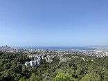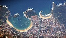


A bay is a recessed, coastal body of water that directly connects to a larger main body of water, such as an ocean, a lake, or another bay. [1] [2] [3] A large bay is usually called a gulf, sea, sound, or bight. A cove is a small, circular bay with a narrow entrance. A fjord is an elongated bay formed by glacial action. [4] The term embayment is also used for related features, such as extinct bays or freshwater environments.
A bay can be the estuary of a river, such as the Chesapeake Bay, an estuary of the Susquehanna River. [2] Bays may also be nested within each other; for example, James Bay is an arm of Hudson Bay in northeastern Canada. Some large bays, such as the Bay of Bengal and Hudson Bay, have varied marine geology.[ citation needed]
The land surrounding a bay often reduces the strength of winds and blocks waves. Bays may have as wide a variety of shoreline characteristics as other shorelines. In some cases, bays have beaches, which "are usually characterized by a steep upper foreshore with a broad, flat fronting terrace". [5] Bays were significant in the history of human settlement because they provided easy access to marine resources like fisheries. [6] Later they were important in the development of sea trade as the safe anchorage they provide encouraged their selection as ports. [7]
Definition
The United Nations Convention on the Law of the Sea defines a bay as a well-marked indentation in the coastline, whose penetration is in such proportion to the width of its mouth as to contain land-locked waters and constitute more than a mere curvature of the coast. An indentation, however, shall not be regarded as a bay unless its area is as large as (or larger than) that of the semi-circle whose diameter is a line drawn across the mouth of that indentation — otherwise it would be referred to as a bight. [8] [a]
Types

- Open bay — a bay that is widest at the mouth, flanked by headlands.
- Enclosed bay — a bay whose mouth is narrower than its widest part, flanked by at least one peninsula.
- Semi-enclosed bay — an open bay whose exit is made into narrower channels by one or more islands within its mouth.
Formation

There are various ways in which bays can form. The largest bays have developed through plate tectonics. [7] As the super-continent Pangaea broke up along curved and indented fault lines, the continents moved apart and left large bays; these include the Gulf of Guinea, the Gulf of Mexico, and the Bay of Bengal, which is the world's largest bay. [7]
Bays also form through coastal erosion by rivers and glaciers. [7] A bay formed by a glacier is a fjord. Rias are created by rivers and are characterised by more gradual slopes. Deposits of softer rocks erode more rapidly, forming bays, while harder rocks erode less quickly, leaving headlands.
See also
- Bay platform – Dead-end railway platform at a railway station that has through lines
- Great capes – Three major capes of the traditional clipper route
Notes
- ^ "For the purposes of this Convention, a bay is a well-marked indentation whose penetration is in such proportion to the width of its mouth as to contain land-locked waters and constitute more than a mere curvature of the coast. An indentation shall not, however, be regarded as a bay unless its area is as large as, or larger than, that of the semi-circle whose diameter is a line drawn across the mouth of that indentation. For the purpose of measurement, the area of an indentation is that lying between the low-water mark around the shore of the indentation and a line joining the low-water mark of its natural entrance points. Where, because of the presence of islands, an indentation has more than one mouth, the semi-circle shall be drawn on a line as long as the sum total of the lengths of the lines across the different mouths. Islands within an indentation shall be included as if they were part of the water area of the indentation." [8]
References
- ^ "Definition of BAY". Merriam-Webster. Archived from the original on March 21, 2017. Retrieved March 21, 2017.
- ^ a b "Chesapeake Bay, Maryland". Maryland Manual On-Line. Maryland State Archives. November 28, 2016. Archived from the original on March 16, 2017. Retrieved March 21, 2017.
- ^ "bay". Dictionary.com Unabridged. Random House, Inc. Archived from the original on March 22, 2017. Retrieved March 21, 2017.
- ^ "What is a Fjord, and how is it formed". Norway Today. 2016-05-08. Archived from the original on 2017-12-25. Retrieved 2017-12-30.
- ^ Maurice Schwartz, Encyclopedia of Coastal Science (2006), p. 129.
- ^ Jones, Terry L. (July 1991). "Marine-Resource Value and the Priority of Coastal Settlement: A California Perspective". American Antiquity. 56 (3): 419–443. doi: 10.2307/280893. ISSN 0002-7316.
- ^ a b c d Carreck, Rosalind, ed. (1982). The Family Encyclopedia of Natural History. The Hamlyn Publishing Group. p. 202. ISBN 978-0-11-202257-2.
- ^ a b United Nations Convention on the Law of the Sea
- ^ "Spatial distribution of water level impact to back-barrier bays". U.S. Geological Survey. Retrieved 2023-08-09.

