Cloverdale, Illinois | |
|---|---|
 Cloverdale, Illinois  Cloverdale, Illinois | |
| Coordinates: 41°56′22″N 88°07′13″W / 41.93944°N 88.12028°W | |
| Country | United States |
| State | Illinois |
| County | DuPage |
| Township | Bloomingdale |
| Elevation | 768 ft (234 m) |
| Time zone | UTC-6 ( Central (CST)) |
| • Summer ( DST) | UTC-5 (CDT) |
| ZIP code | 60103 |
| Area code(s) | 630 & 331 |
| GNIS feature ID | 421755 [1] |
Cloverdale is an unincorporated community in Bloomingdale Township, DuPage County, Illinois, United States. Cloverdale is located near Old Gary Avenue and Army Trail Road, near Bloomingdale.
History
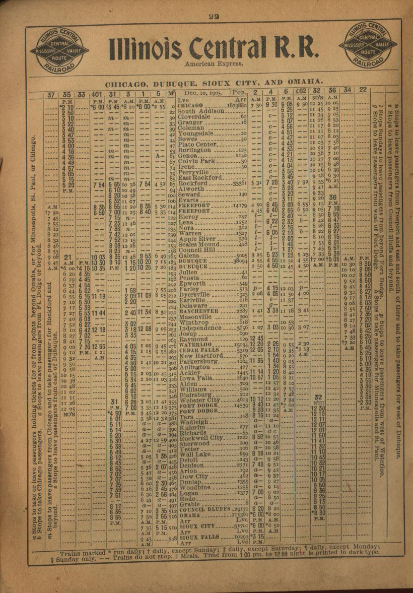
From the late 1880s, Cloverdale was a milk stop on the Illinois Central Gulf railroad, [2] and during the early 1900s, it was a stop on the Chicago, Dubuque, Sioux City and Omaha line of the Illinois Central Railroad. [3]
References
- ^ U.S. Geological Survey Geographic Names Information System: Cloverdale, Illinois
- ^ Crisler, Amy E. "Glendale Heights". History of DuPage County. Archived from the original on December 21, 2011. Retrieved December 6, 2013.
- ^ "Railway Guide-IC, YMV Schedules". Illinois-Central.net. Thomas S. Parker & individual contributors. March 1906. Retrieved December 6, 2013.
Municipalities and communities of
DuPage County, Illinois, United States | ||
|---|---|---|
| Cities |  | |
| Villages |
| |
| Townships | ||
|
Unincorporated communities | ||
| Ghost towns/Neighborhoods | ||
| Footnotes | ‡This populated place also has portions in an adjacent county or counties | |
|
| This DuPage County, Illinois location article is a stub. You can help Wikipedia by expanding it. |