Chbar Ampov
ច្បារអំពៅ | |
|---|---|
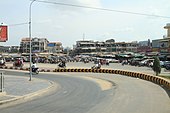
 Chbar Ampov Skyline | |
 Location of Chbar Ampov within Phnom Penh | |
| Coordinates: 11°31′22.08″N 104°58′1.199″E / 11.5228000°N 104.96699972°E | |
| Country | |
| Province | Phnom Penh |
| Area | |
| • Total | 86.7 km2 (33.5 sq mi) |
| Population (2019)
[1] | |
| • Total | 164,379 |
| Time zone | UTC+7 ( ICT) |
Chbar Ampov ( Khmer: ច្បារអំពៅ, Chbar Âmpŏu [cɓaː ɑmpɨw]; meaning "Sugarcane Garden") is a district ( khan) in central Phnom Penh, Cambodia.
Formed in December 2013 by splitting eight communes from neighbouring Khan Mean Chey, [2] Chbar Ampov is located on the east of Phnom Penh, and is separated from the city by the Bassac river.
Administration
Chbar Ampov is subdivided into 8 Sangkats and 50 Villages. [3] [4]
| No. | Postal Code | Sangkat (commune) | Phum (villages) |
|---|---|---|---|
| 1 | 121201 | Chbar Ampov I | Preaek, Daeum Meakkloea, Daeum Ampil |
| 2 | 121202 | Chbar Ampov II | Daeum Chan, Kandal, Daeum Slaeng, Deum Chan I, Kandal I |
| 3 | 121203 | Nirouth | Ta Ngov, Boeung Chhuk, Russei Sraoh, Koh Norea, Ta Ngov Kandal, Ta Ngov Kraom, Deum Slaeng I |
| 4 | 121204 | Prek Pra | Chroy Basak, Preah Ponlea, Prek Ta Pov, Ou Andoung, Chrouy Basak Muoy, Ou Andoung Muoy |
| 8 | 121205 | Veal Sbov | Kdei Ta Koy, Veal Sbov, Svay Ta Ok, Prek Cheang Prum, Svay Ta Ok 1 |
| 5 | 121206 | Prek Aeng | Kbal Chroy, Ta Prum, Mittapheap, Tuol Ta Chan, Chong Prek, Roboah Angkanh, Mitakpheap 1, Chong Preaek 1, Roboah Angkanh 1 |
| 7 | 121207 | Kbal Koh | Chroy Ampil, Yok Bat, Prek Thum, Chrouy Ampil 1, Chrouy Ampil 2, Yok Bat 1, Preaek Thum 1, Preaek Thum 2 |
| 6 | 121208 | Prek Thmei | Campuh K'aek, Koh Krabei, Prek Thmei, Campuh K'aek 1, Koh Krabei 1, Prek Thmei 1 |
Transport
Two bridges span the Bassac river to the capital in the district's north, and one bridge in the south connects to Takhmao Municipality.
The Monivong Bridge on National Road 1 connects Sangkat Cbhar Ampov I to Khan Chamcarmon, while the Koh Pich-Koh Norea Bridge which opened October 2023 [5] links the nascent Koh Norea island development to Koh Pich in Sangkat Tonle Basak. The Cambodia-China Friendship Takhmao Bridge connects National Road 1 to National Road 2.
Construction of a fourth bridge, the Chak Angre Krom-Prek Pra Bridge (formerly named the Prek Talong bridge [6]), was inagurated in February 2024 [7]. The bridge will connect Sangkat Prek Pra to Chung Kong Boulevard in Sangkat Chak Angre Kraom, Mean Chey district. The boulevard will eventually extend from Chamkar Doung Road Khmer: ផ្លូវ ចំការដូង (២១៧) in Dangkao district to National Road 1 in Sangkat Veal Sbov, Chbar Ampov.
Development
The growth of residential development in Khan Chbar Ampov has been significant since 2013. This area has transitioned from being predominantly rural and agricultural to a rapidly developing urban area. This transformation is part of the broader urban expansion seen across Phnom Penh, driven by economic growth and increasing urbanization [8].
This economic vitality has driven the demand for residential spaces, pushing developments further from the city center into districts like Khan Chbar Ampov. The area's appeal has been bolstered by relatively lower land prices compared to central Phnom Penh [9], attracting a diverse range of projects from affordable borey housing to condos and luxury estates by developers including Peng Huoth [10] and BIC Development [11].
Koh Norea
Koh Norea, also known as Norea City, is an ongoing major urban development project located on an island at the confluence of the Mekong River and Bassac River in Phnom Penh, Cambodia. The $2.5 billion project is being developed by the Overseas Cambodia Investment Corporation (OCIC) with the aim of transforming the island into a thriving mixed-use riverfront district and landmark in Phnom Penh's real estate landscape.
Development Plans
OCIC's master plan envisions Koh Norea being developed into an ultra-modern mini-city [12] featuring:
- Residential: High-end condominiums, villas, and apartment complexes
- Hospitality: Luxury hotels and a convention center
- Commercial: Shopping malls, office buildings
- Tourism: Marinas, parks, recreation facilities
- Infrastructure: Road bridges linking to mainland, electricity, water, and waste treatment facilities
The plans emphasize green building design and sustainable urban planning principles. If fully realized, Norea City would have the capacity for over 50,000 residents and workers [13].
History
Historically, the 125 hectare reclamation project Koh Norea was a towhead island. The island has appeared in the earliest French protectorate era maps of Phnom Penh from 1864 through to the early 20th century. [14]

Controversy
While promising to create a modern eco-friendly riverfront district, the massive scale of the development has raised concerns from environmental groups and urban planners about potential negative impacts [12] including:
- Environmental disruption to Mekong/Bassac river ecosystems
- Changes to river morphology, possibly leading to riverbank erosion downstream
- Insufficient urban infrastructure and public services
- Gentrification pressures on existing communities
Education
Chbar Ampov has a growing number of private International and public state schools catering for the areas growing population.
Private schools include:
- British International School of Phnom Penh in Chong Prek, Sangkat Prek Aeng. [15]
- Southbridge International School Cambodia (SISC) [16] within Peng Huoth's borey The Star Platinum Polaris I, in Sangkat Nirouth.
- CIA FIRST International School, Chbar Ampov [17] in Beung Chhuk Village, Sangkat Nirouth
- Sovannaphumi School [18] in Russei Sros Village, Sangkat Nirouth.
- Paññāsāstra International School (PSIS) [19] in Deum Ampil, Sangkat Chbar Ampov I.
- BELTEI International School [20] in Deum Ampil, Sangkat Chbar Ampov I.
Images
-
 Sangkat Chbar Ampov Muoy

References
- ^ "General Population Census of the Kingdom of Cambodia 2019 – Final Results" (PDF). National Institute of Statistics. Ministry of Planning. 26 January 2021. Retrieved 3 February 2021.
- ^ Channyda, Chhay. "New districts signed into being by PM". www.phnompenhpost.com. Retrieved 2022-09-09.
- ^ "Map 12. Administrative Areas in Phnom Penh Municipality by District and Commune" (PDF). National Institute of Statistics, Ministry of Planning (Cambodia). 2013-12-31.
-
^
"Cambodia Gazetteer". Gazetteer Database Online. Retrieved 2024-04-23.
{{
cite web}}
: CS1 maint: url-status ( link) - ^ "Governor inspects new Koh Pich-Koh Norea Bridge - Khmer Times". 2023-10-13. Retrieved 2024-04-23.
- ^ Sivutha, Nov. "Bassac River's Prek Talong Bridge project begins 2022". www.phnompenhpost.com. Retrieved 2022-09-09.
- ^ "CONSTRUCTION OF CHAK ANGRAE KROM-PREK PRA BRIDGE OFFICIALLY OPENED". MPWT. 2024-02-19. Retrieved 2024-04-22.
- ^ "Urban expansion branches out in every direction". www.phnompenhpost.com. Retrieved 2024-04-23.
- ^ "Land prices rise in Prek Pnov, Dangkor and Chbar Ampov - Khmer Times". 2019-07-09. Retrieved 2024-04-23.
- ^ "The Star Platinum Euro Ville - Borey Peng Huoth". boreypenghuoth.com. Retrieved 2024-04-23.
- ^ "One Phnom Penh, Cambodia -". Retrieved 2024-04-23.
- ^ a b Tab, Navet (2020-09-22). "Environmental fears as new Mekong island carved out in Phnom Penh". Southeast Asia Globe. Retrieved 2024-04-23.
- ^ "Koh Norea Satellite City will complete its first phase in 2025". www.compass.com.kh. Retrieved 2024-04-23.
- ^ French Indochina. Service géographique (1928). "Phnom Penh". trove.nla.gov.au (Edition d'Avril 1928 ed.). Publié par le Service géographique de l'Indochine. Retrieved 2024-04-23.
-
^
"Contact Us".
British International School of Phnom Penh. Retrieved 2020-05-14.
The British International School of Phnom Penh No288, Group 28, Street Toul Chherneang, Sangkat Prek Eng, Khan Chbar Ampov, Phnom Penh, Cambodia
- ^ "Southbridge International School Cambodia". Retrieved 2022-09-09.
- ^ "CONTACT US". CIA FIRST International School. Retrieved 2022-09-09.
- ^ "All Campuses - Sovannaphumi". 2016-06-10. Retrieved 2022-09-09.
- ^ "Paññāsāstra International School (PSIS)". www.psis.edu.kh. Retrieved 2022-09-09.
- ^ "BELTEI 5 Background". www.beltei.edu.kh. Retrieved 2022-09-09.
| Autonomous municipality |
| ||
|---|---|---|---|
| Provinces | |||
|
| This Cambodian location article is a stub. You can help Wikipedia by expanding it. |