| Chūō Alps Quasi-National Park | |
|---|---|
| 中央アルプス国定公園 | |
IUCN category II (
national park) | |
 | |
| Location | Nagano Prefecture, Japan |
| Coordinates | 35°47′32″N 137°48′31″E / 35.79222°N 137.80861°E |
| Area | 351.16 square kilometres (135.58 sq mi) |
| Established | 27 March 2020 |
|
| |
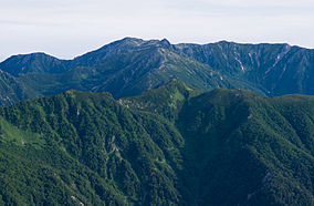
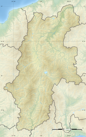
Chūō Alps Quasi-National Park (中央アルプス国定公園, Chūō Arupusu Kokutei Kōen) is a Quasi-National Park in southern Nagano Prefecture, Japan. Established in 2020, the park has an area at time of foundation of 351.16 square kilometres (135.58 sq mi), corresponding exactly to that of the former Chūō Alps Prefectural Natural Park (中央アルプス県立自然公園), founded on 22 November 1951, which it supersedes and replaces. [1] The Park's central feature is the Central Alps. Three separate areas of the park span the borders of thirteen municipalities: Achi, Agematsu, Iida, Iijima, Ina, Kiso, Komagane, Matsukawa, Miyada, Nagiso, Ōkuwa, Shiojiri, and Takamori. [2] [3] [4]
See also
References
- ^ "Chuo alps". Protected Planet. Retrieved 11 June 2021.
- ^ 57カ所目となる国定公園「中央アルプス国定公園」が誕生します。 [Birth of the 57th Quasi-National Park (Chuo Alps Quasi-National Park)] (in Japanese). Ministry of the Environment. 27 March 2020. Retrieved 8 July 2020.
- ^ 長野県の自然公園の紹介 [Introduction to the Natural Parks of Nagano Prefecture] (in Japanese). Nagano Prefecture. 25 June 2020. Retrieved 8 July 2020.
- ^ 自然公園指定状況一覧 [List of designated natural parks] (PDF) (in Japanese). Nagano Prefecture. Archived from the original (PDF) on 20 June 2012. Retrieved 25 April 2012.
External links
- (in Japanese) Map of Chūō Alps Quasi-National Park
Categories:
- IUCN Category II
- Parks and gardens in Nagano Prefecture
- Protected areas established in 2020
- 2020 establishments in Japan
- Achi, Nagano
- Agematsu, Nagano
- Iida, Nagano
- Iijima, Nagano
- Ina, Nagano
- Kiso, Nagano (town)
- Komagane, Nagano
- Matsukawa, Nagano (Shimoina)
- Miyada, Nagano
- Nagiso, Nagano
- Ōkuwa, Nagano
- Shiojiri, Nagano
- Takamori, Nagano
- Japan protected area stubs

