Bostancı | |
|---|---|
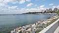
 Bostancı pier | |
 Bostancı inside Kadıköy | |
| Country | Turkey |
| Province | Istanbul |
| District | Kadıköy |
| Population (2022) | 33,638 |
| Time zone | UTC+3 ( TRT) |
Bostancı (Turkish: [bosˈtandʒɯ]) is a neighbourhood in the municipality and district of Kadıköy, Istanbul Province, Turkey. [1] Its population is 33,638 (2022). [2] It is on the Anatolian side of Istanbul, on the shore of the Sea of Marmara. [3] As the easternmost neighbourhood of the Kadıköy district; it borders Suadiye and Kozyatağı (also neighbourhoods of Kadıköy) to the west, İçerenköy (a neighbourhood of Ataşehir) to the north, and Altıntepe (a neighbourhood of Maltepe) to the east.
A predominantly residential area, Bostancı is an important transport interchange with stops on the Marmaray and M4 Metro lines and ferries leaving for the Princes' Islands in the Sea of Marmara. It is generally considered the starting point of Bağdat Avenue, the major shopping street that runs as far as Kadıköy.
Because of its position on the water, Bostancı has several fish restaurants. It is also popular as a place to stop off for late night fast food. Several places stay open all night serving people returning from the bars and clubs on Bağdat Avenue.

History
In the Byzantine period Bostancı was probably called Poleatikon. When the emperors returned from campaigning in Anatolia, the city chief would greet them here and it is thought that there was a palace for the emperor here.
When the Umayyad forces besieged Constantinople (now Istanbul) in 718, their navy took refuge in the port here.
During the Ottoman period, the main road connecting the capital to Anatolia passed through Bostancı, which was the eastern border of the city. A Bostanji (a type of imperial guard, whose name literally means "gardener" in Turkish) outpost was established here where they could control the entrances and exits to Istanbul. The neighbourhood took its name from this outpost.
Transport
From Bostancı, five of the Princes' Islands - Kınalıada, Burgazada, Heybeliada, Büyükada, and Sivriada - can be seen. Bostancı is also an important interchange for the Asian side of Istanbul with copious city buses, sea buses, commuter ferries, trains and dolmuşes. All intercity trains heading for Anatolia stop at Bostancı railway station, which is opposite the Bostancı pier.

- 2 Balaban
- 4 Ring
- 10B Kadıköy
- 10S Kadıköy
- 17S Yenimahalle
- 128 Mecidiyeköy-Mezarlık
- 129T Taksim
- 134BK Yahya Tahir Sokak
Inner city
- İDO Kadıköy
- İDO Kabataş
- İDO Kadıköy- Yenikapı- Bakırköy
- İDO Maltepe
- İDO Büyükada- Heybeliada- Burgazada- Kınalıada- Kabataş
Intercity
Images
-
 Sunset in Bostancı
 -
 Bostancı Coast
 -
 View of Bostancı from Altıntepe
 -
 Historical Station of Bostancı
 -
 Bostancı Subway
 -
 Bostanji Guards
.jpeg)


40°57′29″N 29°05′48″E / 40.9581685°N 29.0968046°E
References
- ^ Mahalle, Turkey Civil Administration Departments Inventory. Retrieved 12 July 2023.
- ^ "Address-based population registration system (ADNKS) results dated 31 December 2022, Favorite Reports" (XLS). TÜİK. Retrieved 12 July 2023.
- ^ "Neighbourhood of Bostancı" (in Turkish). Governorship of Kadıköy, Istanbul. 2009. Archived from the original on 2009-09-12. Retrieved 2009-08-05.
- ^ "2011 Kış Tarifesi" (PDF) (in Turkish). IDO. Archived from the original (PDF) on 2012-01-05. Retrieved 2012-02-05.
External links
- Miscellaneous images of Bostancı (in Turkish)
| International | |
|---|---|
| National | |
|
| This geographical article about a location in Istanbul Province, Turkey is a stub. You can help Wikipedia by expanding it. |