Bonaventura | ||||||||||||||||
|---|---|---|---|---|---|---|---|---|---|---|---|---|---|---|---|---|
 Bonaventura station platform in 2012 | ||||||||||||||||
| General information | ||||||||||||||||
| Location | 1st Street and Bonaventura Drive San Jose, California | |||||||||||||||
| Coordinates | 37°23′17″N 121°55′45″W / 37.387980°N 121.929250°W | |||||||||||||||
| Owned by | Santa Clara Valley Transportation Authority | |||||||||||||||
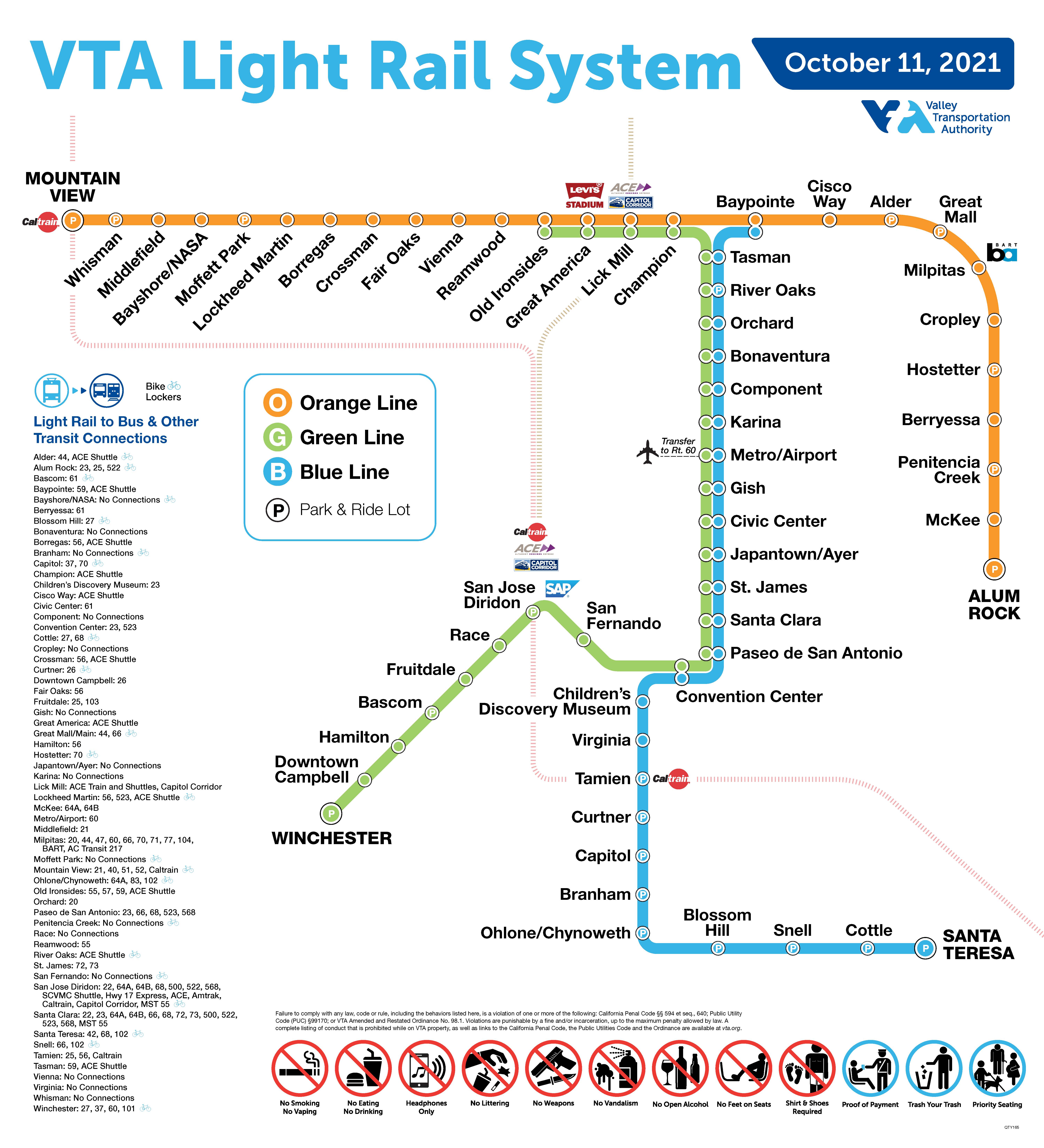
| Line(s) | Guadalupe Phase 1 | |||||||||||||||
| Platforms | 2 side platforms | |||||||||||||||
| Tracks | 2 | |||||||||||||||
| Connections | ||||||||||||||||
| Construction | ||||||||||||||||
| Structure type | At-grade | |||||||||||||||
| Accessible | Yes | |||||||||||||||
| History | ||||||||||||||||
| Opened | December 11, 1987 [2] | |||||||||||||||
| Services | ||||||||||||||||
| ||||||||||||||||
| Location | ||||||||||||||||
|
| ||||||||||||||||
Bonaventura station is an at-grade light rail station located in the center median of First Street at its intersection with Bonaventura Drive, after which the station is named, in San Jose, California. The station is owned by Santa Clara Valley Transportation Authority (VTA) and is served by the Blue Line and the Green Line of the VTA light rail system.
Services
Platform layout
Bonaventura has a split platform with the northbound platform north of Bonaventura Drive and the southbound platform just to the south.
References
- ^ "VTA Light Rail System". Santa Clara Valley Transportation Authority. October 11, 2021. Retrieved 2022-02-04.
- ^ "VTA Facts: Light Rail System" (PDF). Santa Clara Valley Transportation Authority. November 30, 2006. Archived from the original (PDF) on March 20, 2009. Retrieved January 10, 2020.
External links
-
 Media related to
Bonaventura (VTA) at Wikimedia Commons
Media related to
Bonaventura (VTA) at Wikimedia Commons
|
| This article related to light rail in the United States is a stub. You can help Wikipedia by expanding it. |
|
| This Santa Clara County, California train station-related article is a stub. You can help Wikipedia by expanding it. |
Categories:
- Santa Clara Valley Transportation Authority light rail stations
- Railway stations in San Jose, California
- 1987 establishments in California
- Railway stations in the United States opened in 1987
- United States light rail stubs
- Santa Clara County, California railway station stubs
- San Jose, California building and structure stubs