Bird City, Kansas | |
|---|---|
 Location within
Cheyenne County and
Kansas | |
 | |
| Coordinates: 39°45′10″N 101°31′58″W / 39.75278°N 101.53278°W [1] | |
| Country | United States |
| State | Kansas |
| County | Cheyenne |
| Founded | 1885 |
| Incorporated | 1885 |
| Named for | Benjamin Bird |
| Area | |
| • Total | 2.27 sq mi (5.87 km2) |
| • Land | 2.27 sq mi (5.87 km2) |
| • Water | 0.00 sq mi (0.00 km2) |
| Elevation | 3,468 ft (1,057 m) |
| Population | |
| • Total | 437 |
| • Density | 190/sq mi (74/km2) |
| Time zone | UTC-6 ( CST) |
| • Summer ( DST) | UTC-5 (CDT) |
| ZIP code | 67731 |
| Area code | 785 |
| FIPS code | 20-06825 |
| GNIS ID | 2394172 [1] |
| Website | birdcity.com |
Bird City is a city in Cheyenne County, Kansas, United States. [1] As of the 2020 census, the population of the city was 437. [3]
History
Bird City was founded in 1885. [4] It was named for Benjamin Bird, a cattleman. [5] The surrounding area was originally used predominately for livestock grazing. [6]
Bird City was a station and shipping point on the Chicago, Burlington and Quincy Railroad. [7]

Geography
According to the United States Census Bureau, the city has a total area of 2.23 square miles (5.78 km2), all land. [8]
Climate
According to the Köppen Climate Classification system, Bird City has a semi-arid climate, abbreviated "BSk" on climate maps. [9]
Demographics
| Census | Pop. | Note | %± |
|---|---|---|---|
| 1890 | 145 | — | |
| 1900 | 88 | −39.3% | |
| 1910 | 190 | 115.9% | |
| 1920 | 489 | 157.4% | |
| 1930 | 740 | 51.3% | |
| 1940 | 694 | −6.2% | |
| 1950 | 784 | 13.0% | |
| 1960 | 678 | −13.5% | |
| 1970 | 671 | −1.0% | |
| 1980 | 546 | −18.6% | |
| 1990 | 467 | −14.5% | |
| 2000 | 482 | 3.2% | |
| 2010 | 447 | −7.3% | |
| 2020 | 437 | −2.2% | |
| U.S. Decennial Census | |||
2020 census
The 2020 United States census counted 437 people, 205 households, and 112 families in Bird City. [10] [11] The population density was 192.9 per square mile (74.5/km2). There were 271 housing units at an average density of 119.6 per square mile (46.2/km2). [11] [12] The racial makeup was 81.24% (355) white or European American (75.29% non-Hispanic white), 0.0% (0) black or African-American, 0.0% (0) Native American or Alaska Native, 0.46% (2) Asian, 0.0% (0) Pacific Islander or Native Hawaiian, 7.55% (33) from other races, and 10.76% (47) from two or more races. [13] Hispanic or Latino of any race was 17.16% (75) of the population. [14]
Of the 205 households, 23.4% had children under the age of 18; 44.4% were married couples living together; 29.8% had a female householder with no spouse or partner present. 40.5% of households consisted of individuals and 22.9% had someone living alone who was 65 years of age or older. [11] The average household size was 2.0 and the average family size was 3.0. [15] The percent of those with a bachelor’s degree or higher was estimated to be 27.2% of the population. [16]
23.6% of the population was under the age of 18, 4.8% from 18 to 24, 18.8% from 25 to 44, 28.1% from 45 to 64, and 24.7% who were 65 years of age or older. The median age was 47.8 years. For every 100 females, there were 96.0 males. [11] For every 100 females ages 18 and older, there were 104.9 males. [11]
The 2016-2020 5-year American Community Survey estimates show that the median household income was $38,125 (with a margin of error of +/- $14,601) and the median family income was $55,938 (+/- $8,435). [17] Males had a median income of $32,031 (+/- $11,747) versus $31,164 (+/- $2,780) for females. The median income for those above 16 years old was $31,472 (+/- $3,424). [18] Approximately, 5.8% of families and 9.7% of the population were below the poverty line, including 3.1% of those under the age of 18 and 24.3% of those ages 65 or over. [19] [20]
2010 census
As of the census [21] of 2010, there were 447 people, 211 households, and 118 families residing in the city. The population density was 200.4 inhabitants per square mile (77.4/km2). There were 264 housing units at an average density of 118.4 per square mile (45.7/km2). The racial makeup of the city was 96.2% White, 0.4% Native American, 0.9% from other races, and 2.5% from two or more races. Hispanic or Latino of any race were 15.0% of the population.
There were 211 households, of which 24.2% had children under the age of 18 living with them, 48.3% were married couples living together, 7.1% had a female householder with no husband present, 0.5% had a male householder with no wife present, and 44.1% were non-families. 40.8% of all households were made up of individuals, and 24.6% had someone living alone who was 65 years of age or older. The average household size was 2.12 and the average family size was 2.91.
The median age in the city was 47.4 years. 24.2% of residents were under the age of 18; 4% were between the ages of 18 and 24; 19.9% were from 25 to 44; 26.1% were from 45 to 64; and 25.7% were 65 years of age or older. The gender makeup of the city was 48.5% male and 51.5% female.
2000 census
As of the census [22] of 2000, there were 482 people, 232 households, and 128 families residing in the city. The population density was 216.1 inhabitants per square mile (83.4/km2). There were 285 housing units at an average density of 127.8 per square mile (49.3/km2). The racial makeup of the city was 99.17% White, 0.21% Native American, 0.21% from other races, and 0.41% from two or more races. Hispanic or Latino of any race were 2.90% of the population.
There were 232 households, out of which 22.8% had children under the age of 18 living with them, 49.1% were married couples living together, 4.3% had a female householder with no husband present, and 44.4% were non-families. 43.1% of all households were made up of individuals, and 28.4% had someone living alone who was 65 years of age or older. The average household size was 2.08 and the average family size was 2.88.
In the city, the population was spread out, with 23.9% under the age of 18, 3.7% from 18 to 24, 19.7% from 25 to 44, 19.1% from 45 to 64, and 33.6% who were 65 years of age or older. The median age was 48 years. For every 100 females, there were 87.5 males. For every 100 females age 18 and over, there were 79.0 males.
The median income for a household in the city was $25,714, and the median income for a family was $32,589. Males had a median income of $24,531 versus $17,500 for females. The per capita income for the city was $16,680. About 15.0% of families and 17.7% of the population were below the poverty line, including 25.9% of those under age 18 and 9.2% of those age 65 or over.
Education
The community is served by Cheylin USD 103 public school district. [23] School unification consolidated Bird City and McDonald schools in 1975 creating USD 103. [24] The Cheylin High School mascot is Cheylin Cougars.
Bird City High School was closed through school unification. The Bird City High School mascot was Cardinals. [25]
References
- ^ a b c d U.S. Geological Survey Geographic Names Information System: Bird City, Kansas
- ^ "2019 U.S. Gazetteer Files". United States Census Bureau. Retrieved July 24, 2020.
- ^ a b "Profile of Bird City, Kansas in 2020". United States Census Bureau. Archived from the original on November 13, 2021. Retrieved November 13, 2021.
- ^ "Cheyenne County". Blue Skyways. Kansas State Library. Retrieved June 6, 2014.
- ^ "Profile for Bird City, Kansas". ePodunk. Archived from the original on July 14, 2014. Retrieved June 6, 2014.
- ^ "History". City of Bird City, Kansas. Archived from the original on July 14, 2014. Retrieved June 6, 2014.
- ^ Blackmar, Frank Wilson (1912). Kansas: A Cyclopedia of State History, Embracing Events, Institutions, Industries, Counties, Cities, Towns, Prominent Persons, Etc. Standard Publishing Company. pp. 186.
- ^ "US Gazetteer files 2010". United States Census Bureau. Archived from the original on January 25, 2012. Retrieved July 6, 2012.
- ^ Climate Summary for Bird City, Kansas
- ^ "US Census Bureau, Table P16: HOUSEHOLD TYPE". data.census.gov. Retrieved January 2, 2024.
- ^ a b c d e "US Census Bureau, Table DP1: PROFILE OF GENERAL POPULATION AND HOUSING CHARACTERISTICS". data.census.gov. Retrieved January 2, 2024.
- ^ Bureau, US Census. "Gazetteer Files". Census.gov. Retrieved December 30, 2023.
- ^ "US Census Bureau, Table P1: RACE". data.census.gov. Retrieved January 2, 2024.
- ^ "US Census Bureau, Table P2: HISPANIC OR LATINO, AND NOT HISPANIC OR LATINO BY RACE". data.census.gov. Retrieved January 2, 2024.
- ^ "US Census Bureau, Table S1101: HOUSEHOLDS AND FAMILIES". data.census.gov. Retrieved January 2, 2024.
- ^ "US Census Bureau, Table S1501: EDUCATIONAL ATTAINMENT". data.census.gov. Retrieved January 2, 2024.
- ^ "US Census Bureau, Table S1903: MEDIAN INCOME IN THE PAST 12 MONTHS (IN 2020 INFLATION-ADJUSTED DOLLARS)". data.census.gov. Retrieved January 2, 2024.
- ^ "US Census Bureau, Table S2001: EARNINGS IN THE PAST 12 MONTHS (IN 2020 INFLATION-ADJUSTED DOLLARS)". data.census.gov. Retrieved January 2, 2024.
- ^ "US Census Bureau, Table S1701: POVERTY STATUS IN THE PAST 12 MONTHS". data.census.gov. Retrieved January 2, 2024.
- ^ "US Census Bureau, Table S1702: POVERTY STATUS IN THE PAST 12 MONTHS OF FAMILIES". data.census.gov. Retrieved January 2, 2024.
- ^ "U.S. Census website". United States Census Bureau. Retrieved July 6, 2012.
- ^ "U.S. Census website". United States Census Bureau. Retrieved January 31, 2008.
- ^ "Cheylin USD 103". USD 103. Retrieved January 7, 2017.
- ^ "Cheylin provides new name in Liberty loop", The Salina Journal, 7 September 1975, p.
- ^ "Bird City is AA Loop Champ", The Salina Journal, 21 November 1954, p.19.
Further reading
External links
Municipalities and communities of
Cheyenne County, Kansas, United States | ||
|---|---|---|
| Cities | 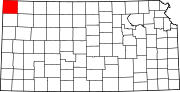 | |
|
Unincorporated communities | ||
| Townships | ||
| International | |
|---|---|
| National | |