Antioch Baptist Church | |
 | |
 | |
| Location | 1057 Texas Avenue Shreveport, Louisiana |
|---|---|
| Coordinates | 32°30′14″N 93°45′13″W / 32.50388°N 93.75366°W |
| Area | 0.3 acres (0.12 ha) |
| Built | 1903 |
| Architect | Nathanial Sykes Allen |
| Architectural style | Romanesque Revival |
| Part of | St. Paul's Bottoms ( ID84000033) |
| NRHP reference No. | 82000431 [1] |
| Significant dates | |
| Added to NRHP | November 1, 1982 |
| Designated CP | July 9, 1999 |
Antioch Baptist Church is a historic church located in Shreveport, Louisiana.
On April 23, 1866, two leaders of the First Baptist Church honorably dismissed 73 black members of its church so they could begin construction of a new black, Baptist church. This church came to be known as the First Colored Baptist Church of Shreveport. The original building was dedicated on August 18, 1871. In the late 1800s, the church bought land on Texas Avenue and began construction of a new church. As the church was being built, a storm destroyed the entire structure. The leaders of the First Colored Baptist Church decided to rebuild the structure at a cost of $3,198.45. This new church, designed by Nathaniel Sykes Allen, was dedicated at 1057 Texas Avenue in 1903. Soon after its dedication, the church was renamed Union Missionary Baptist Church. Finally, the church was renamed once more, to Antioch Baptist Church. [2]
The structure is built of red brick and white trim. The church became a member of the National Baptist Convention, USA, Inc. in 1906. The church has been renovated two times since its original dedication, in 1943 and 1958 respectively. The church was added to the National Register of Historic Places in 1982. [2] [3]
The church also became a contributing property of St. Paul's Bottoms historic district when its boundaries were increased on July 9, 1999. [4]
References
- ^ "National Register Information System". National Register of Historic Places. National Park Service. July 9, 2010.
- ^ a b Daniel J. Thomas (October 1981). "National Register of Historic Places Inventory/Nomination Form: Antioch Baptist Church". National Park Service. Retrieved April 10, 2018. With nine photos from 1981.
- ^ " Antioch Baptist Archived November 11, 2012, at the Wayback Machine". Parish of Caddo. Retrieved on September 13, 2012.
- ^ "St. Paul's Bottoms" (PDF). State of Louisiana's Division of Historic Preservation. Retrieved April 13, 2018.[ permanent dead link]
See also

Municipalities and communities of
Caddo Parish, Louisiana, United States | ||
|---|---|---|
| City | 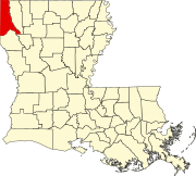 | |
| Towns | ||
| Villages | ||
| CDP | ||
|
Other communities |
| |
| Ghost town |
| |
| Footnotes | ‡This populated place also has portions in an adjacent parish or parishes | |
|
| This article about a church or other Christian place of worship in Louisiana is a stub. You can help Wikipedia by expanding it. |
|
| This article about a property in Louisiana on the National Register of Historic Places is a stub. You can help Wikipedia by expanding it. |
- Individually listed contributing properties to historic districts on the National Register
- Baptist churches in Louisiana
- Churches in Shreveport, Louisiana
- Churches on the National Register of Historic Places in Louisiana
- Churches completed in 1903
- Romanesque Revival church buildings in Louisiana
- National Register of Historic Places in Caddo Parish, Louisiana
- Individually listed contributing properties to historic districts on the National Register in Louisiana
- Louisiana church stubs
- Louisiana Registered Historic Place stubs