| Alt Pirineu Natural Park | |
|---|---|
| Parc Natural de l'Alt Pirineu | |
IUCN category V (protected landscape/seascape) | |
 | |
Location of the natural park in
Catalonia | |
| Location | Province of Lleida, Catalonia, Spain |
| Coordinates | 42°29′46″N 1°12′38″E / 42.49611°N 1.21056°E |
| Area | 69,850 hectares (172,600 acres) |
| Established | 2003 |
| Governing body | Generalitat de Catalunya |
|
www | |
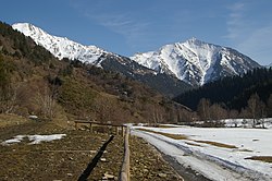
Alt Pirineu Natural Park ( Catalan: Parc Natural de l'Alt Pirineu) is the largest natural park in Catalonia, Spain. The park was established in 2003 by the Generalitat de Catalunya and covers an area of 69,850 hectares (172,600 acres), including the highest peaks of the Pyrenees in Catalonia. It stretches over the comarques of Pallars Sobirà and Alt Urgell. [1] [2]
References
- ^ "Alt Pirineu Natural Park". Diputació de Lleida - ARA LLEIDA. lleidatur.com. Retrieved February 5, 2012.
- ^ Marta Pallarès (December 31, 2004). "PARC NATURAL DE L'ALT PIRINEU". Observatori de projectes i debats territorials de Catalunya (in Catalan). scot.cat. Retrieved February 5, 2012.
External links
- Official website (in Catalan and Spanish)
