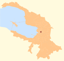
59°53′38″N 30°15′50″E / 59.894°N 30.264°E

Admiralteysky Municipal Okrug ( Russian: Адмиралте́йский муниципа́льный о́круг) is a municipal okrug of Admiralteysky District of the federal city of St. Petersburg, Russia. Population: 22,634 ( 2010 Census); [1] 30,533 ( 2002 Census). [2]
It borders the Neva River in the north, New Admiralty Canal and Kryukov Canal in the west, Fontanka in the south, and Voznesensky Avenue and the Moyka River in the east.
Places of interest include the Admiralty building, Saint Isaac's Cathedral, Mariinsky Palace, Decembrists Square, and Mariinsky Theatre.
References
- ^ Russian Federal State Statistics Service (2011). Всероссийская перепись населения 2010 года. Том 1 [2010 All-Russian Population Census, vol. 1]. Всероссийская перепись населения 2010 года [2010 All-Russia Population Census] (in Russian). Federal State Statistics Service.
- ^ Russian Federal State Statistics Service (May 21, 2004). Численность населения России, субъектов Российской Федерации в составе федеральных округов, районов, городских поселений, сельских населённых пунктов – районных центров и сельских населённых пунктов с населением 3 тысячи и более человек [Population of Russia, Its Federal Districts, Federal Subjects, Districts, Urban Localities, Rural Localities—Administrative Centers, and Rural Localities with Population of Over 3,000] (XLS). Всероссийская перепись населения 2002 года [All-Russia Population Census of 2002] (in Russian).
