53 Street | ||||||||||||||||||||||||||||||||||||||||||||||||||||||||||||||||||||
|---|---|---|---|---|---|---|---|---|---|---|---|---|---|---|---|---|---|---|---|---|---|---|---|---|---|---|---|---|---|---|---|---|---|---|---|---|---|---|---|---|---|---|---|---|---|---|---|---|---|---|---|---|---|---|---|---|---|---|---|---|---|---|---|---|---|---|---|---|
|
| ||||||||||||||||||||||||||||||||||||||||||||||||||||||||||||||||||||
.jpg) Northbound R train arriving at the station | ||||||||||||||||||||||||||||||||||||||||||||||||||||||||||||||||||||
| Station statistics | ||||||||||||||||||||||||||||||||||||||||||||||||||||||||||||||||||||
| Address | 53rd Street &
Fourth Avenue Brooklyn, NY 11220 | |||||||||||||||||||||||||||||||||||||||||||||||||||||||||||||||||||
| Borough | Brooklyn | |||||||||||||||||||||||||||||||||||||||||||||||||||||||||||||||||||
| Locale | Sunset Park | |||||||||||||||||||||||||||||||||||||||||||||||||||||||||||||||||||
| Coordinates | 40°38′41″N 74°00′52″W / 40.64472°N 74.01444°W | |||||||||||||||||||||||||||||||||||||||||||||||||||||||||||||||||||
| Division | B ( BMT) [1] | |||||||||||||||||||||||||||||||||||||||||||||||||||||||||||||||||||
| Line | BMT Fourth Avenue Line | |||||||||||||||||||||||||||||||||||||||||||||||||||||||||||||||||||
| Services |
N
R W | |||||||||||||||||||||||||||||||||||||||||||||||||||||||||||||||||||
| Transit | ||||||||||||||||||||||||||||||||||||||||||||||||||||||||||||||||||||
| Structure | Underground | |||||||||||||||||||||||||||||||||||||||||||||||||||||||||||||||||||
| Platforms | 2 side platforms | |||||||||||||||||||||||||||||||||||||||||||||||||||||||||||||||||||
| Tracks | 4 | |||||||||||||||||||||||||||||||||||||||||||||||||||||||||||||||||||
| Other information | ||||||||||||||||||||||||||||||||||||||||||||||||||||||||||||||||||||
| Opened | September 22, 1915 [3] | |||||||||||||||||||||||||||||||||||||||||||||||||||||||||||||||||||
| Closed | March 27, 2017 (reconstruction) | |||||||||||||||||||||||||||||||||||||||||||||||||||||||||||||||||||
| Rebuilt | September 8, 2017 | |||||||||||||||||||||||||||||||||||||||||||||||||||||||||||||||||||
| Opposite- direction transfer | Yes | |||||||||||||||||||||||||||||||||||||||||||||||||||||||||||||||||||
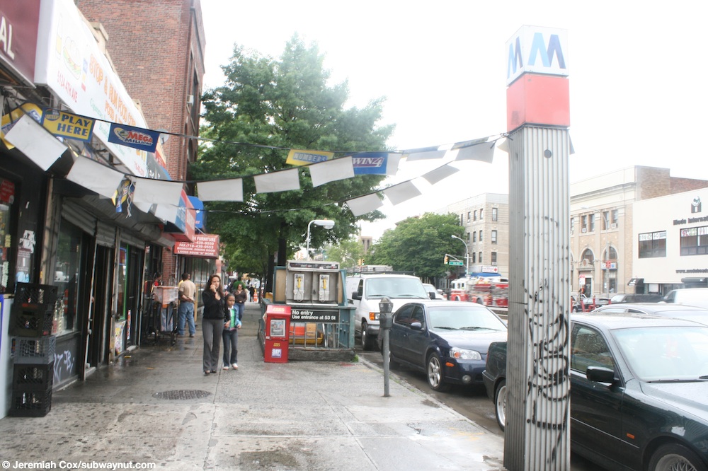
| Other entrances/ exits | Fourth Avenue and 53rd Street, Fourth Avenue and 52nd Street (southbound only) | |||||||||||||||||||||||||||||||||||||||||||||||||||||||||||||||||||
| Traffic | ||||||||||||||||||||||||||||||||||||||||||||||||||||||||||||||||||||
| 2023 | 2,018,914
[4] | |||||||||||||||||||||||||||||||||||||||||||||||||||||||||||||||||||
| Rank | 163 out of 423 [4] | |||||||||||||||||||||||||||||||||||||||||||||||||||||||||||||||||||
| ||||||||||||||||||||||||||||||||||||||||||||||||||||||||||||||||||||
| ||||||||||||||||||||||||||||||||||||||||||||||||||||||||||||||||||||
| ||||||||||||||||||||||||||||||||||||||||||||||||||||||||||||||||||||
| ||||||||||||||||||||||||||||||||||||||||||||||||||||||||||||||||||||
| ||||||||||||||||||||||||||||||||||||||||||||||||||||||||||||||||||||


The 53rd Street station is a local station on the BMT Fourth Avenue Line of the New York City Subway. Located at 53rd Street and Fourth Avenue in Sunset Park, Brooklyn, it is served by the R train at all times. The N train also stops here during late nights, and some rush-hour W trains stop here in the peak direction.
The 53rd Street station was constructed as part of the Fourth Avenue Line, which was approved in 1905. Construction on the segment of the line that includes 53rd Street started on March 15, 1913, and was completed in 1915. The station opened on September 22, 1915, after the opening of the initial portion of the BMT Fourth Avenue Line to 59th Street. [3] The station's platforms were lengthened in 1926–1927, [6] and again during a renovation in 1968–1970. [7] The station was renovated again in 2017.
History
Construction and opening

The 53rd Street station was constructed as part of the Fourth Avenue Line, the plan for which was initially adopted on June 1, 1905. [8] The Rapid Transit Commission was succeeded on July 1, 1907, by the New York State Public Service Commission (PSC), which approved the plan for the line in late 1907. [9] [10]
As part of negotiations between New York City, the Brooklyn Rapid Transit Company (BRT), and the Interborough Rapid Transit Company for the expansion of the city's transit network, the line was leased to a subsidiary of the BRT. The agreement, known as Contract 4 of the Dual Contracts, was signed on March 19, 1913. [9] In 1912, during the Dual System negotiations, the construction of an extension of the Fourth Avenue subway from 43rd Street to 89th Street, just south of the 86th Street station, was recommended. The proposal was approved by the Board of Estimate on February 15, 1912. The PSC directed its chief engineer to create plans on June 14, 1912. The two contracts for the extension, Route 11B, were awarded on September 16, 1912, to Degnon Construction Company for a combined $3.8 million (equivalent to $120 million in 2023). [9]
Construction on Route 11B1, the section of the extension between 43rd Street and 61st Street, which includes the 53rd Street station, began on March 15, 1913. Originally, this section was planned to have two tracks, but after the connection to the Sea Beach Line was added to the plan during the middle of construction, the plan was changed to four tracks. This section was completed in 1915. [8] The section of the line running through the 53rd Street station opened on June 22, 1915, as part of an extension of the subway to Coney Island, which included the Fourth Avenue Line north of 59th Street as well as the entire Sea Beach Line. [11] [12] The line's opening was marked with a competition between two trains heading from Chambers Street station in Manhattan to the Coney Island station, one heading via the West End Line and the other via the Sea Beach Line; the latter got to Coney Island first. [12] However, the 45th and 53rd Street stations remained closed, [13] despite being technically complete, since the stations were being used by a contractor to haul dirt out. [14] The stations opened on September 22, 1915. [3]
Station renovations
1920s
On June 27, 1922, the New York State Transit Commission commissioned its engineers to examine platform-lengthening plans for 23 stations on the lines of the Brooklyn–Manhattan Transit Corporation (BMT), the successor to the BRT, to accommodate eight-car trains. As part of the project, 53rd Street's platforms would have been lengthened from 495 feet (151 m) to 530 feet (160 m). [15] Though the Transit Commission ordered the BMT to lengthen these platforms in September 1923, progress on the extensions did not occur until February 16, 1925, when the New York City Board of Transportation (NYCBOT) commissioned its engineers to examine platform-lengthening plans for this and eleven other stations along the Fourth Avenue Line. It estimated the project would cost $633,000 (equivalent to $10,998,000 in 2023) (equivalent to $10,998,000 in 2023). [16] The NYCBOT received bids for the project on February 25, 1926. [17] The contract was awarded to the Corson Construction Company for $345,021 (equivalent to $5,938,000 in 2023) (equivalent to $5,938,000 in 2023). [18] The extensions opened on August 1, 1927. [6]
1960s

The city government took over the BMT's operations on June 1, 1940. [19] [20] In the 1960s, the New York City Transit Authority (NYCTA) started a project to lengthen station platforms on its lines in Southern Brooklyn to 615 feet (187 m) to accommodate 10-car trains. [7] On July 14, 1967, the NYCTA awarded a contract to conduct test borings at eleven stations on the Fourth Avenue Line, including 53rd Street, to the W. M. Walsh Corporation for $6,585 (equivalent to $60,172 in 2023) in preparation of the construction of platform extensions (equivalent to $60,000 in 2023). [21] The NYCTA issued an invitation for bids on the project to extend the platforms at stations along the Fourth Avenue Line between 45th Street station and Bay Ridge—95th Street, including this station, on May 3, 1968. [22]
As part of the renovation project, the station's platforms were extended 85 feet (26 m) to the south, [7] [23] [24] and the station's elaborate mosaic tile walls were covered over with 8-by-16-inch (20 by 41 cm) white cinderblock tiles. The latter change, which was also made to fifteen other stations on the BMT Broadway and Fourth Avenue Line, was criticized for being dehumanizing. The NYCTA spokesman stated that the old tiles were in poor condition and that the change was made to improve the appearance of stations and provide uniformity. Furthermore, it did not consider the old mosaics to have "any great artistic merit". [25]
2017
As part of the Metropolitan Transportation Authority's 2015–2019 Capital Program, the station, along with thirty other New York City Subway stations, were scheduled to undergo a complete overhaul as part of the Enhanced Station Initiative. Updates were to include cellular service, Wi-Fi, USB charging stations, interactive service advisories and maps, improved signage, and improved station lighting. [26] [27] From January to May 2016, Grimshaw Architects worked on a design for the station's renovation, with Arup Group acting as a consultant. [28] The award for Package 1 of the renovations, which covered renovations at the Prospect Avenue, 53rd Street, and Bay Ridge Avenue stations on the BMT Fourth Avenue Line, was awarded on November 30, 2016. [28] Citnalta-Forte Joint Venture was selected to renovate the three stations under a $72 million design–build contract, the first such contract in the subway system's history. [29] The station was closed on March 27, 2017, for these renovations, [30] [31] [32] and reopened on September 8, 2017, [33] ahead of schedule. [34]
Station layout
| Ground | Street level | Exit/entrance |
| Mezzanine | Fare control, station agent | |
| Platform level | Side platform | |
| Northbound local | ←
← ← | |
| Northbound express | ←
| |
| Southbound express |
| |
| Southbound local |
| |
| Side platform | ||

This underground station has four tracks and two side platforms. [35] The R stops here at all times; [36] some rush-hour W trains stop here in the peak direction; [37] and the N stops here during late nights, but uses the center express tracks to bypass the station during daytime hours. [38] The station is between 45th Street to the north and 59th Street to the south. [39]
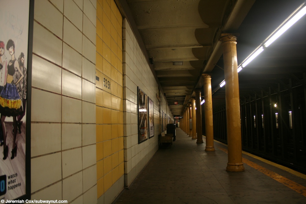
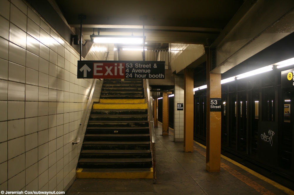
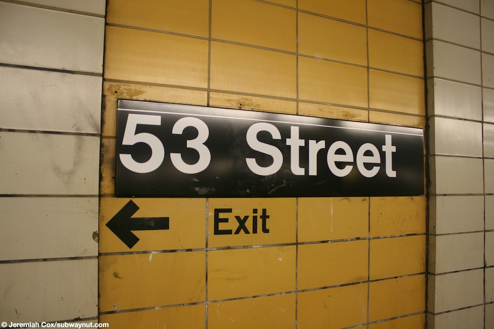
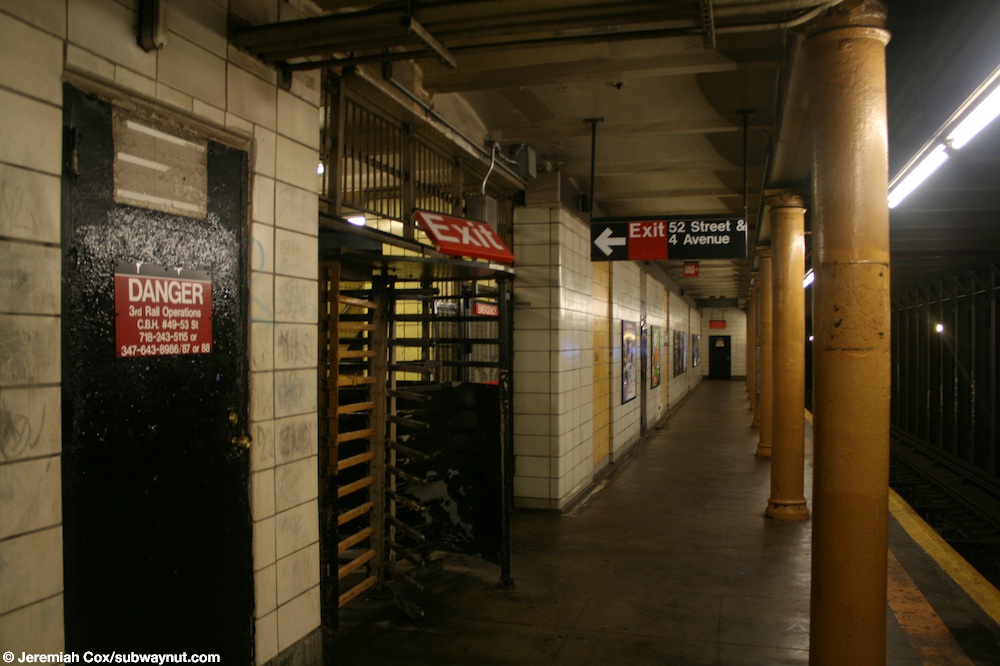
Columns run along the entire length of both platforms and are painted black. [24] Every other column has a "53 Street" sign on it in black with white text. [40] All are rounded except for the ones near the two staircases to the station's main entrance, which was where the platforms were extended in 1970. [24]
Prior to the station's 1970 renovation, it was finished all in white and marble tile, and it had its own color scheme to allow regular passengers to identify the station based only on the color of the marble trimmings. [9] Since that renovation, the station walls have consisted of white cinderblock tiles, except for small recesses in the walls, which contain yellow-painted cinderblock tiles. The yellow cinderblock field contains the station-name signs and black text pointing to the exits. [41] [42] During the 2017 renovation, the cinderblock tiles were refurbished and colored white with small recesses containing black tiles. ADA-compliant platform treads and a granite tiled floor, as well as indirect lighting atop the station wall, which was relocated from above the platform edge, were installed. [43] [44] [45]
The 2017 artwork at this station consists of nature-inspired mosaics by Brooklyn-based artist Mickalene Thomas. [33] [34]
Exits
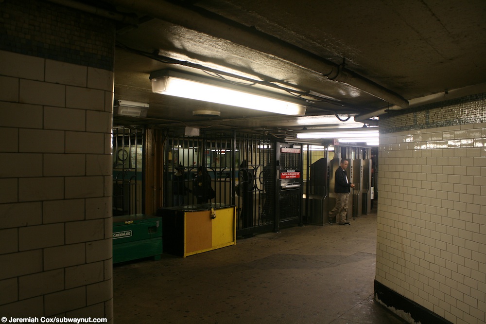
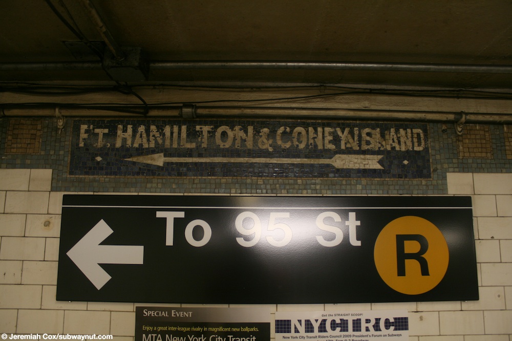
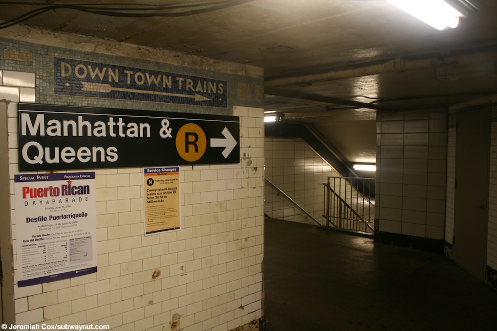
The station's main entrance has two staircases to each platform and one to each northern corner of Fourth Avenue and 53rd Street. The mezzanine allows transfer between directions and contains some original mosaic directional and arrow signs. [46] [47] The one by the staircases to the southbound platform displays "Ft. Hamilton & Coney Island" while the one by the Manhattan-bound platform staircases displays "Down Town Trains." [48] [49]
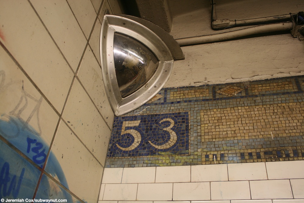
The southbound platform has an additional entrance near the north end. [50] Two platform-level turnstiles lead to a small landing before a three-flight staircase goes up to 52nd Street and Fourth Avenue. Prior to the 2017 renovation, the entrance was exit-only. [47] [51] The landing area contained the original 1915 trim band with a single "53" tiled on it prior to the renovation of the station. [52]


.jpg)
References
- ^ "Glossary". Second Avenue Subway Supplemental Draft Environmental Impact Statement (SDEIS) (PDF). Vol. 1. Metropolitan Transportation Authority. March 4, 2003. pp. 1–2. Archived from the original (PDF) on February 26, 2021. Retrieved January 1, 2021.
- ^ "Brooklyn Bus Map" ( PDF). Metropolitan Transportation Authority. October 2020. Retrieved December 1, 2020.
- ^
a
b
c "Stations of Subway are Now Opened". Home Talk the Item. September 22, 1915. pp.
1,
14 – via newspapers.com
 .
.
- ^ a b "Annual Subway Ridership (2018–2023)". Metropolitan Transportation Authority. 2023. Retrieved April 20, 2024.
- ^ "Annual Subway Ridership (2018–2023)". Metropolitan Transportation Authority. 2023. Retrieved April 20, 2024.
- ^
a
b
"B.M.T. Stations Ready For Eight-Car Trains". Brooklyn Standard Union. August 1, 1927. p. 1. Retrieved April 9, 2020 – via newspapers.com
.
- ^ a b c New York City Transit Authority Annual Report For The Year June 30, 1960. New York City Transit Authority. 1960. pp. 16–17.
- ^ a b Rogoff, David (May 1961). "The Fourth Ave. Subway". New York Division Bulletin. Electric Railroaders' Association: 2–10. Retrieved May 8, 2017.
- ^ a b c d Fourth Avenue Subway, Brooklyn's New Transportation Line: A Part of the Dual System of Rapid Transit of the City of New York. New York City: Public Service Commission. June 19, 1915. p. 18. hdl: 2027/uiug.30112067596715 – via HathiTrust.
-
^
"Fourth Avenue Subway Is Sent To A Committee". The Brooklyn Daily Eagle. March 20, 1908. pp. 1–2. Retrieved May 4, 2017 – via newspapers.com
.
- ^ Cudahy, Brian J. (2009). How We Got to Coney Island: The Development of Mass Transportation in Brooklyn and Kings County. Fordham University Press. pp. 217–218. ISBN 978-0-8232-2211-7. Retrieved April 24, 2020.
- ^
a
b
"Through Tube to Coney, 48 Minutes: First Train on Fourth Avenue Route Beats West End Line Eleven Minutes". The Brooklyn Daily Eagle. June 22, 1915. Retrieved June 29, 2015 – via newspapers.com
.
-
^
"Celebration of Opening Fourth Ave. Subway". Home Talk the Item. June 23, 1915. p. 1. Retrieved April 9, 2020 – via newspapers.com
.
-
^ "Stations Ready, But Are Not Available". Home Talk the Item. July 21, 1915. pp.
1,
2 – via newspapers.com
.
- ^ Proceedings of the Transit Commission, State of New York Volume III From January 1 to December 31, 1923. New York State Transit Commission. 1923. p. 1277.
- ^ "12 B-M. T. Stations To Be Lengthened". The New York Times. February 17, 1925. ISSN 0362-4331. Retrieved May 4, 2017.
-
^
"Board Receives Platform Bids For B.M.T. Lines. Six Companies Submit Prices for Extending Subway Stations". The Brooklyn Citizen. February 26, 1926. p. 5. Retrieved April 7, 2020 – via newspapers.com
.
-
^
"Brooklyn Wins Big Improvement Fund". Brooklyn Standard Union. March 18, 1926. p. 20. Retrieved April 7, 2020 – via newspapers.com
.
- ^ "B.M.T. Lines Pass to City Ownership; $175,000,000 Deal Completed at City Hall Ceremony-- Mayor 'Motorman No. 1'". The New York Times. June 2, 1940. ISSN 0362-4331. Archived from the original on July 19, 2021. Retrieved May 14, 2022.
- ^ "City Takes Over B. M. T. System; Mayor Skippers Midnight Train". New York Herald Tribune. June 2, 1940. p. 1. ProQuest 1243059209.
- ^ Minutes and Proceedings. New York City Transit Authority. 1967. pp. 379–380.
- ^ Engineering News-record. McGraw-Hill. 1968. p. 75.
- ^ Rogoff, Dave (February 1969). "BMT Broadway Subway Platform Extensions" (PDF). New York Division Bulletin. 12 (1). Electric Railroaders' Association: 4. Archived from the original (PDF) on September 15, 2020. Retrieved May 22, 2020.
- ^ a b c Cox, Jeremiah (June 9, 2009). "A final view down the Bay Ridge-bound side platform with its narrow columns at 53 Street". subwaynut.com. Archived from the original on March 27, 2017. Retrieved March 26, 2017.
- ^ Burks, Edward C. (February 21, 1970). "Subways' Colored Tile Gets Cover-Up Job". The New York Times. ISSN 0362-4331. Retrieved April 7, 2020.
- ^ Whitford, Emma (January 8, 2016). "MTA Will Completely Close 30 Subway Stations For Months-Long "Revamp"". Gothamist. Archived from the original on August 1, 2016. Retrieved July 18, 2016.
- ^ "MTAStations" (PDF). governor.ny.gov. Government of the State of New York. Retrieved July 18, 2016.
- ^ a b "Capital Program Oversight Committee Meeting" (PDF). mta.info. Metropolitan Transportation Authority. November 2016. Retrieved November 27, 2016.
- ^ "Three Brooklyn R Stations are First in Major Subway Station Modernization Project". Metropolitan Transportation Authority. March 22, 2017. Archived from the original on August 21, 2019. Retrieved August 31, 2017.
- ^ Spivack, Caroline (January 16, 2017). "Shuttle scuttle: Riders demand extra buses during three subway stations' closure". Brooklyn Paper. Retrieved January 27, 2017.
- ^ "MTA will close these Brooklyn subway stops to facilitate upgrades". Curbed NY. March 22, 2017. Retrieved March 24, 2017.
- ^ "Trains skip 53 St in both directions". mta.info. Metropolitan Transportation Authority. March 26, 2017. Archived from the original on March 26, 2017. Retrieved March 26, 2017.
- ^ a b DeJesus, Jaime (September 8, 2017). "Sunset Park's renovated 53rd Street station is open for business". Brooklyn Reporter. Retrieved September 8, 2017.
- ^ a b "Newly renovated R train subway station transforms into commuter dream with USB ports, countdown clocks". New York's PIX11 / WPIX-TV. September 9, 2017. Retrieved September 10, 2017.
- ^ Dougherty, Peter (2006) [2002]. Tracks of the New York City Subway 2006 (3rd ed.). Dougherty. OCLC 49777633 – via Google Books.
- ^ "R Subway Timetable, Effective August 28, 2023". Metropolitan Transportation Authority. Retrieved August 26, 2023.
- ^ "W Subway Timetable, Effective June 26, 2022". Metropolitan Transportation Authority. Retrieved August 26, 2023.
- ^ "N Subway Timetable, Effective August 28, 2023". Metropolitan Transportation Authority. Retrieved August 26, 2023.
- ^ "Subway Map" ( PDF). Metropolitan Transportation Authority. September 2021. Retrieved September 17, 2021.
- ^ Cox, Jeremiah (June 9, 2009). "A staircase up to the small mezzanine area and fare control form the Bay Ridge-bound platform at 53 Street". subwaynut.com. Archived from the original on March 27, 2017. Retrieved March 26, 2017.
- ^ Cox, Jeremiah (June 9, 2009). "A 53 Street platform sign, text and a arrow for 52 St is painted beneath this one". subwaynut.com. Archived from the original on March 8, 2016. Retrieved March 26, 2017.
- ^ Cox, Jeremiah (June 9, 2009). "A 53 Street platform sign, text and a arrow for 52 St is painted beneath this one". subwaynut.com. Retrieved March 26, 2017.
- ^ "Enhanced 53rd Street R Subway Station Opens in Sunset Park". mta.info. Metropolitan Transportation Authority. September 8, 2017. Retrieved April 14, 2020.
- ^ "Reopening of 53rd St ESI Station". Flickr.com. Metropolitan Transportation Authority. September 8, 2017. Retrieved April 14, 2020.
- ^ "53 Street Station Before Renewal". Flickr.com. Metropolitan Transportation Authority. September 2, 2016. Retrieved April 14, 2020.
- ^ Cox, Jeremiah (June 9, 2009). "Looking back towards the entrance turnstiles on the mezzanine level at 53 Street". subwaynut.com. Archived from the original on March 27, 2017. Retrieved March 26, 2017.
- ^ a b "MTA Neighborhood Maps: Sunset Park" (PDF). mta.info. Metropolitan Transportation Authority. 2015. Retrieved August 2, 2015.
- ^ Cox, Jeremiah (June 9, 2009). "A unique mosaic says Ft. Hamilton & Coney Island and points towards the platform To 95 Street at 53 Street". subwaynut.com. Archived from the original on March 27, 2017. Retrieved March 26, 2017.
- ^ Cox, Jeremiah (June 9, 2009). "The passageway that leads to the two staircases down to the Down Town Trains platform at 53 Street". subwaynut.com. Archived from the original on March 8, 2016. Retrieved March 26, 2017.
- ^ Cox, Jeremiah (June 9, 2009). "Another view approaching the High Exit Gate that leads to 52 St". subwaynut.com. Archived from the original on March 8, 2016. Retrieved March 26, 2017.
- ^ Cox, Jeremiah (June 9, 2009). "A M subway entrance column with red on it on 4th Avenue, and the No Entry staircase down to the exit from 52 Street". subwaynut.com. Archived from the original on March 9, 2016. Retrieved March 26, 2017.
- ^ Cox, Jeremiah (June 9, 2009). "The only 53 tiling in the single band of trim that is still visible after passing through the High Exit gate that leads out to 52 St". subwaynut.com. Archived from the original on March 9, 2016. Retrieved March 26, 2017.
External links
| External videos | |
|---|---|
- nycsubway.org – BMT 4th Avenue: 53rd Street
- Station Reporter — R Train
- The Subway Nut — 53rd Street Pictures Archived January 5, 2018, at the Wayback Machine
- Rebuilt Platforms from Google Maps Street View
- Rebuilt Mezzanine from Google Maps Street View
- Rebuilt 53rd Street Entrance from Google Maps Street View