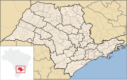
Águas da Prata | |
|---|---|
| Municipality of Águas da Prata | |
 | |
 Location in São Paulo | |
| Coordinates: 21°56′29″S 46°43′0″W / 21.94139°S 46.71667°W | |
| Country | |
| Region | Southeast |
| State | |
| Area | |
| • Total | 143 km2 (55 sq mi) |
| Population (2020)
[1] | |
| • Total | 8,221 |
| • Density | 57/km2 (150/sq mi) |
| Time zone | UTC−3 ( BRT) |
| HDI (2010) | 0.781 – high [2] |
Águas da Prata is a Brazilian municipality in the state of São Paulo. The population is 8,221 (2020 est.) in an area of 143 km². [3]
References
- ^ IBGE 2020
-
^
"Archived copy" (PDF).
United Nations Development Programme (UNDP). Archived from
the original (PDF) on July 8, 2014. Retrieved August 1, 2013.
{{
cite web}}
: CS1 maint: archived copy as title ( link) - ^ Instituto Brasileiro de Geografia e Estatística


