Grabowhöfe | |
|---|---|
| Coordinates: 53°34′N 12°35′E / 53.567°N 12.583°E | |
| Country | Germany |
| State | Mecklenburg-Vorpommern |
| District | Mecklenburgische Seenplatte |
| Municipal assoc. | Seenlandschaft Waren |
| Government | |
| • Mayor | Elke Schult |
| Area | |
| • Total | 43.06 km2 (16.63 sq mi) |
| Elevation | 68 m (223 ft) |
| Population (2022-12-31)
[1] | |
| • Total | 1,355 |
| • Density | 31/km2 (82/sq mi) |
| Time zone | UTC+01:00 ( CET) |
| • Summer ( DST) | UTC+02:00 ( CEST) |
| Postal codes | 17194 |
| Dialling codes | 03991, 039926 |
| Vehicle registration | MÜR |
| Website |
www |
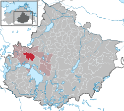
Grabowhöfe is a municipality in the Mecklenburgische Seenplatte district, in Mecklenburg-Vorpommern, Germany.
References
- ^ "Bevölkerungsstand der Kreise, Ämter und Gemeinden 2022" (XLS) (in German). Statistisches Amt Mecklenburg-Vorpommern. 2023.


