Assumption Island Airport | |||||||||||
|---|---|---|---|---|---|---|---|---|---|---|---|
| Summary | |||||||||||
| Airport type | Private | ||||||||||
| Operator | Islands Development Corporation (IDC) [1] | ||||||||||
| Location | Assumption Island, Seychelles | ||||||||||
| Elevation AMSL | 10 ft / 3 m | ||||||||||
| Coordinates | 09°44′32″S 46°30′24″E / 9.74222°S 46.50667°E | ||||||||||
| Map | |||||||||||
| Runways | |||||||||||
| |||||||||||
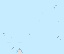
Assumption Island Airport ( ICAO: FSAS) is an airport serving Assumption Island in the Seychelles. The island is 30 kilometres (19 mi) southeast of the Aldabra Atoll and is part of the Aldabra Group.
See also
References
External links
- OpenStreetMap - Assumption
- OurAirports - Assumption
- SkyVector - Assumption
- FallingRain - Assumption Airport
- Accident history for Assumption Airport at Aviation Safety Network
